The state of Utah is home to five U.S National Parks, and there are thousands of great Utah hiking trails to enjoy inside and outside of the parks. This guide is a brief summary of our favorite Utah hikes. In my opinion, these are some of the very best hikes in Utah!
The southern part of Utah state has much of the wonderful desert scenery and slot canyons this state is famous for, while the Salt Lake City area has mountains and alpine lakes that might remind you of Colorado.
There are even a bunch of nice waterfalls scattered across Utah. We’ve spent months exploring this state and it never disappoints. Regardless of where you go while hiking in Utah, you’re sure to find some unique and fantastic scenery around every corner.
From the canyons of Escalante to the lakes of the Wasatch Range, here’s our complete Utah hiking guide!
Best Hikes In Utah
1. Angels Landing Hike (Zion)
Angels Landing is the king of Utah hikes. If you only do one hike in the national parks, make it this one.
It’s an epic and scary trail that takes you up the side of a steep sandstone mountain, with chains to grab onto for safety, and amazing views of Zion National Park surrounding you on all sides. Permits are required since 2022.
The Angels Landing chain section is especially noted for being hair-raising and hazardous, and there have been a number of falling deaths on this hike over the years, although it’s plenty safe if you stick to the trail.
At times, the trail will only be a few feet wide, and you’ll have to hug the side of the mountain. Not all of this section has chains, but the most sketchy parts do for your safety.

I wouldn’t say the Angels Landing trail is for everyone, but if you enjoy adventure, photography, and a good adrenaline rush, then definitely add it to your bucket list!
The final view at Angels Landing gives you a 360 degree panorama of Zion Canyon, along with the tiny roads and shuttle buses below, and you can even look down at the gigantic peak you just climbed.
It’s easily one of the best views in Zion National Park, but it’s also one of my favorite views on any hike we’ve ever done in our travels around the world.
Distance: 4.5 miles (7.2 km) roundtrip
Elevation Gain: 1,500 feet (460 m)
Difficulty: Hard
Read More: Angels Landing Hike

The craziest view on the Angels Landing hike
2. Observation Point Trail (Zion)
The Observation Point trail is a bit underrated, but it’s easily one of the best hikes in Zion National Park, Utah. This one takes you to a viewpoint above the entire national park.
Spread out in front of you are many of Zion’s best sights like the Great White Throne, Cathedral Mountain, and Angels Landing. We could even see the tiny people hiking to the top of Angels Landing, and the roads and shuttle buses looked like toys in the distance.
The elevation here at Observation Point is more than 700 feet above Angels Landing, so you really do have a bird’s-eye view of Zion National Park.

It’s fantastic scenery, and since this hike is less popular than other places in Zion, you don’t have to worry about sharing it with massive crowds like at The Narrows.
In fact, if you go early on a weekday you may even have the place to yourself, except for a few chipmunks running around looking for snacks.
The main trailhead for this hike was closed as a result of a big rockfall in 2019 that wiped out part of the trail and switchbacks.
However, you can still access Observation Point from the East Mesa Trail, which is actually an easier hike anyway. From this route it’s a relatively short and simple hike with stunning end views, so definitely add it to your Zion bucket list!
Distance: 7 miles (11 km) roundtrip
Elevation Gain: 700 feet (215 m)
Difficulty: Easy / Moderate
Read More: Observation Point Trail
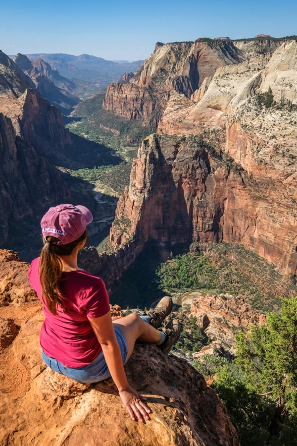
Observation Point Trail in Zion National Park
3. The Narrows (Zion)
Of course I have to mention the mother of all slot canyons, the Zion Narrows!
This is a giant gorge with walls a thousand feet tall, and the Virgin River flows through it. Hiking the Narrows involves walking in water, and if you go the full length it’s 16 miles total.
The good news is that the Narrows is open to all fitness levels because you don’t have to hike to the end of the gorge. You can stop and turn around whenever you want.
It’s possible to hike the entire Narrows from the top down in one full day if you get a permit in advance, but most people just go partway and then turn back (no permit required for that).
The bad news is that the Narrows is getting extremely popular. The crowds kind of ruined it for us. If you’re really intent on seeing the Narrows without crowds, I’d recommend getting a permit and hiking it from the top down. Otherwise, you may want to go to one of the other places in this Utah hiking guide instead.
Distance: 9 – 16 miles (14 – 25 km) roundtrip
Elevation Gain: Minimal
Difficulty: Easy / Moderate
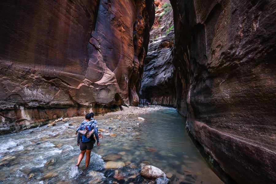
The Zion Narrows may be the most famous slot canyon Utah has to offer
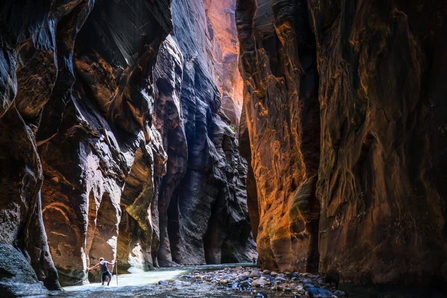
Huge canyon walls of the Zion Narrows
4. Kanarra Canyon & Falls (Zion)
The Kanarra Creek slot canyon is unique for having two waterfalls in the canyon, and it’s just a 1 hour drive from Zion National Park. It’s definitely one of our favorite Utah canyons!
The first waterfall is near the start of the slot canyon, and it’s easy to pass thanks to a new metal ladder that was just installed by the city of Kanarraville. The second waterfall comes into view a bit later.
Overall, I’d probably rate this hike as easy, even though it’s a bit longer and has more elevation gain than many of the slot canyons in Utah.
Nowadays you have to pay for a permit to do the Kanarra Creek hike because of its popularity, and there are a limited number of permits available per day. These sell out often, so you’ll want to plan ahead.
Distance: 4 miles (6.5 km) roundtrip
Elevation Gain: 650 feet (200 m)
Difficulty: Easy
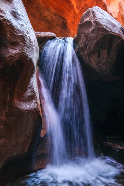
The magnificent walls of Kanarra Creek Slot Canyon
5. Corona Arch Trail (Moab)
The Corona Arch trail is a nice, short hike near Moab, Utah with a total of three different natural sandstone arches.
It’s a fairly easy hike for all ages, and you get to see the Pinto Arch (optional), plus the Bowtie Arch, and then finally the impressive Corona Arch at the end of the trail.
Even though Corona Arch isn’t part of the Arches National Park, it’s definitely one of the best arches in the Moab area! It’s 140 feet wide and 105 feet tall, and you can walk through the arch to the other side, so it’s great for pictures at any time of day.
Best of all, the Corona Arch trailhead is located right outside the town of Moab and the Arches National Park, in eastern Utah. It’s on Potash Road, which is home to some prehistoric dinosaur tracks and a bunch of other interesting sights.
Distance: 2.5 miles (4 km) roundtrip
Elevation Gain: 500 feet (150 m)
Difficulty: Easy / Moderate
Read More: Corona Arch Trail
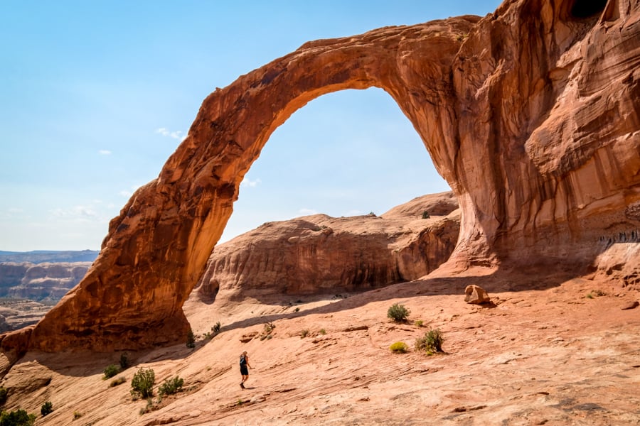
Corona Arch is one of our favorite easy Utah hikes near Moab
6. Delicate Arch Hike (Moab)
The one-of-a-kind Delicate Arch is probably Utah’s most famous state symbol, appearing on everything from license plates to souvenir shirts, calendars, postcards, and more. It’s a beloved icon of the United States.
I really like this arch. There is nothing else like it in the world. Even though there are more than 2,000 natural rock arches at the Arches National Park in Moab, none of them can really compare to this one, in my opinion. It’s too extraordinary.
The hike to Delicate Arch is about 3 miles roundtrip, and the path is family friendly, but the difficulty level largely depends on how hot it is when you go. A blistering hot day will make it tougher.
Along the way, you can also see a historic wooden cabin and some Ute Indian petroglyphs near the start of the trail. All in all, we think it’s one of the best Utah hikes!
Distance: 3.2 miles (5 km) roundtrip
Elevation Gain: 650 feet (200 m)
Difficulty: Easy / Moderate
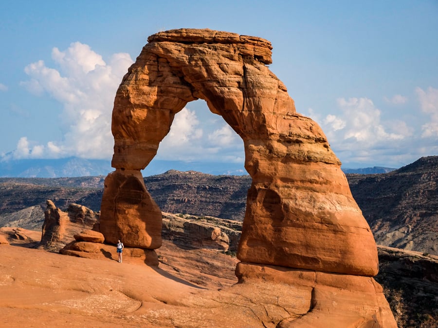
Delicate Arch is the star of Arches National Park
7. Tower Arch Trail (Moab)
The Tower Arch trail is one of the best kept secrets in Arches National Park, with a still-primitive access road and no crowds.
It’s a short and beginner-friendly trail that leads you to a gigantic sandstone arch, which gets its name from the big rock steeple that seems to rise from the top of the arch when you view it from the front. This hike takes about 45-60 minutes each way.
The first sight of Tower Arch is exciting, but I think the view from the opposite side is even better! This arch is 92 feet wide, and like some other arches in the park, you can walk through the middle and look at the arch from the other side, where you get a real sense of its size.
It’s a huge arch, so even with a wide angle lens you have to do a little bit of scrambling on the slick rock in the corner below the arch to get the best pictures of it. The shadow under the arch makes a nice spot to relax and rest in the shade!
Distance: 2.5 miles (4 km) roundtrip
Elevation Gain: 600 feet (180 m)
Difficulty: Easy
Read More: Tower Arch Trail
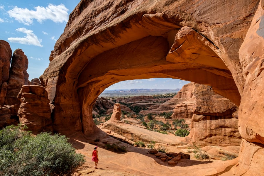
Tower Arch is one of our favorite hikes in Arches National Park.
8. Devils Garden (Moab)
The Devils Garden trail is another great hike in Arches National Park where you can explore a variety of sights, including 8 arches!
One of these features, the Landscape Arch, is easy to reach from the trailhead and it holds the record for being the longest arch in North America. It’s also currently the 4th longest natural arch in the world!
If you hike the entire loop at Devils Garden, I’d rate the difficulty as moderate, although it becomes quite a bit harder if you go in the summer and do the hike during the daytime heat. In any case, bring lots and lots of water for this hike!
Distance: 8 miles (12.8 km) roundtrip
Elevation Gain: 1,100 feet (335 m)
Difficulty: Moderate / Hard
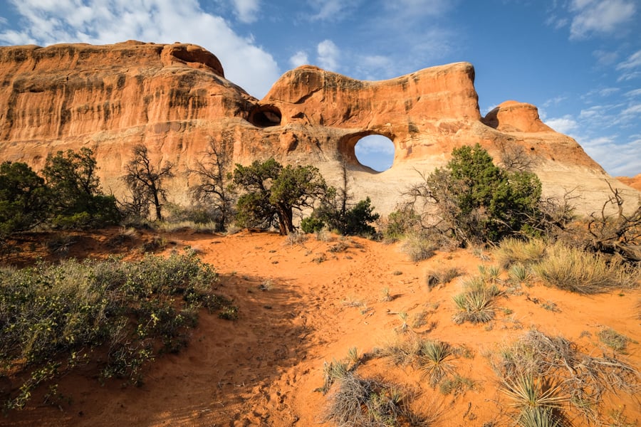
Devils Garden trail in Arches National Park
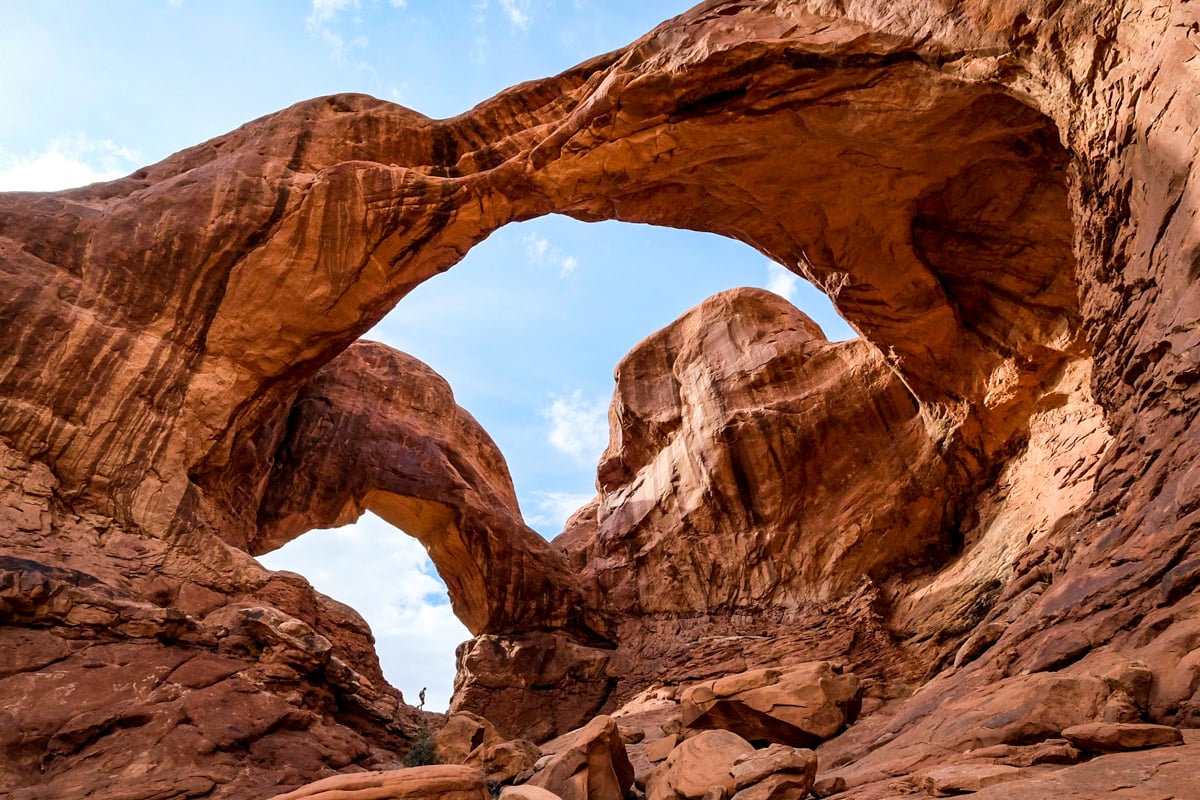
9. Double Arch (Moab)
The five minute hike to Double Arch is probably one of the shortest and easiest hikes in Utah or the Arches National Park, but you’re rewarded with a view that is just fantastic.
These are two giant arches joined together in the middle, claiming the record for the tallest and second-longest arch in the national park.
You can climb up to the main window below the arches if you’re feeling brave, and it’s a nice place to enjoy the breeze and some shade from the sun.
You can find this spot in the ‘Windows Section’ of Arches National Park.
Distance: 0.5 miles (0.8 km) roundtrip
Elevation Gain: Minimal
Difficulty: Easy
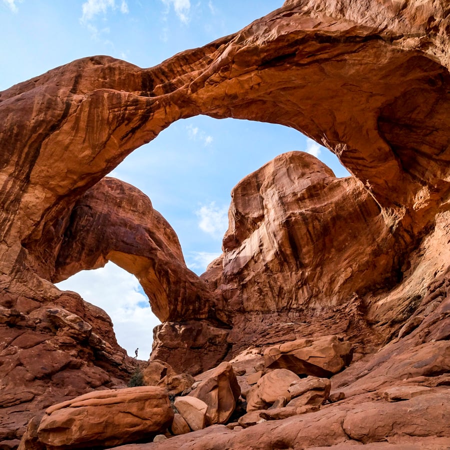
Double Arch in the Arches National Park. See the tiny person?
10. Windows Trail (Moab)
This is another short and easy hike in Moab with amazing rock formations. It’s located right next to the Double Arch trail in Arches National Park, and you can do both hikes from the same parking lot, although the trailheads start on opposite ends of the parking.
This Utah hike features the gigantic sandstone North and South Windows, plus a quick spur trail to Turret Arch. There’s also a longer and more primitive trail that goes around the back side of the two Windows for a unique view where they combine to look like eye glasses (called ‘the Spectacles’).
The North Window is huge — 50 feet high and 90 feet wide — so you have to see it from a distance with people near the Window to get a real sense of scale! It’s not possible to climb on any of these arches, but you can walk through the Turret Arch or into the North Window for a nice view of the other side.
There are lots of fun photo ops on this hike. One of them involves framing Turret Arch through the North Window, so you can see an arch through an arch! Overall, we think it’s one of the easiest and best Utah hikes.
Distance: 1 mile (1.6 km) roundtrip
Elevation Gain: 100 feet (30 m)
Difficulty: Easy
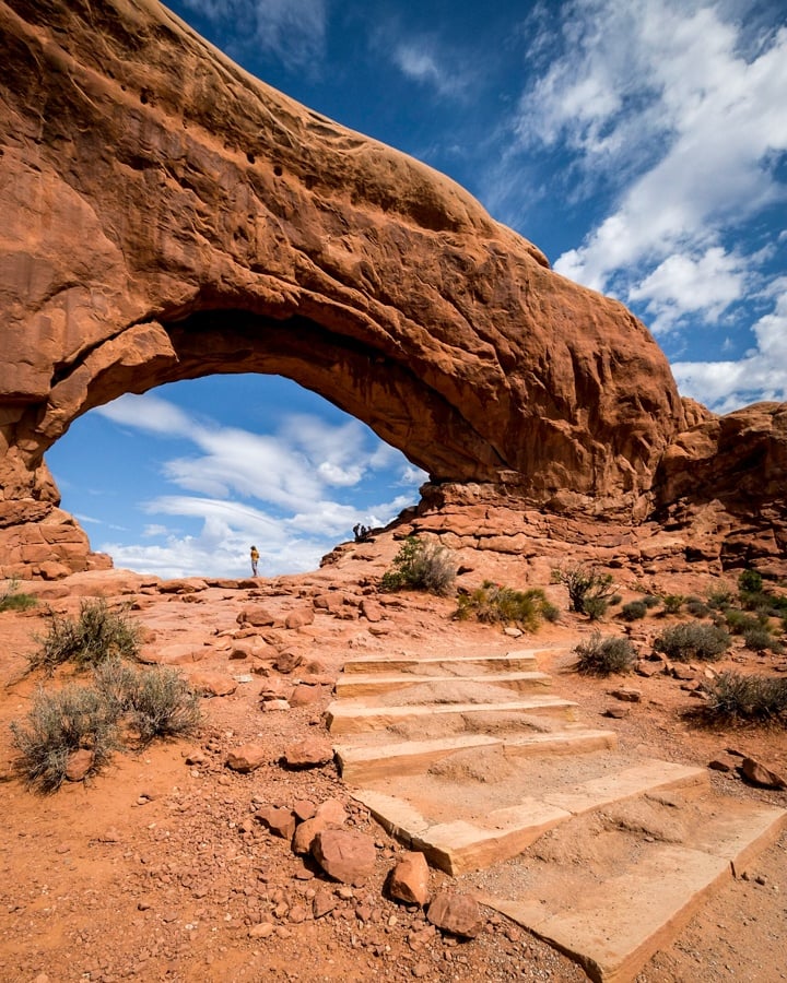
Windows Trail is one of the easiest and best Utah hiking trails
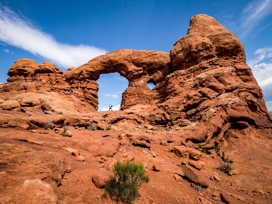
Turret Arch
11. Mesa Arch Loop Trail (Moab)
The Mesa Arch trail may be one of the shortest and easiest hikes in Utah, but it’s a must-do for this amazing arch that frames the sunrise in Canyonlands National Park!
Everyone will tell you to see Mesa Arch at sunrise, and it really is spectacular, but it’s also very crowded with photographers for sunrise trying to get the perfect picture.
If you come in the day time, the crowds aren’t quite as bad, and it’s still well worth it for the amazing cliffside views of the arch, the canyons, and the La Sal Mountains in the distance. This is the Canyonlands National Park at its best!
The short hike to the arch is suitable for families, kids, and all ages, but be careful near the edge of the cliff. It’s a 500 foot drop! The easiest way to do the trail is counterclockwise, that way the elevation gain is a bit smoother on the way back.
Distance: 0.6 miles (1 km) roundtrip
Elevation Gain: 100 feet (30 m)
Difficulty: Easy
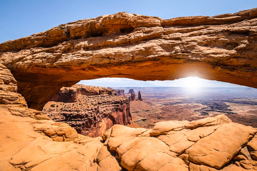
Mesa Arch is famous as one of the best Utah hikes for sunrise, but it’s also great in the daytime.
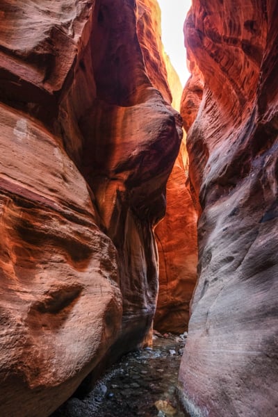
12. Wire Pass / Buckskin Gulch (Escalante)
Buckskin Gulch is the longest slot canyon in the United States, and it’s believed to be the longest slot canyon in the world, at 21 miles!
It’s located by the Utah-Arizona state border, so you can reach it in 1 hour of driving from the town of Page, Arizona, or about 2 hours from Zion National Park.
The best way to visit this slot canyon is by entering from Wire Pass, that way you get to see two slot canyons for the price of one!
Wire Pass is a side canyon that intersects with Buckskin Gulch, and it’s actually easier to enter Buckskin through this route, since you spend much less time walking in the hot sun.
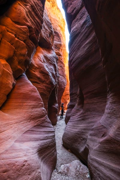
We thought the slot canyon section at Wire Pass was even more photogenic than Buckskin itself.
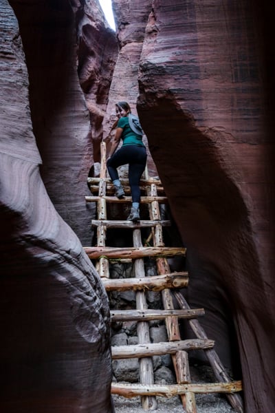
It’s narrow and the colors are terrific. There’s even a little wooden ladder that’s great for pictures. Best of all, this slot dumps you right at the intersection in Buckskin Gulch where you can see some Native American petroglyphs on the canyon wall.
It’s definitely one of the best Utah slot canyons!
Distance: 3.5 miles (5.5 km) for Wire Pass
Elevation Gain: 150 feet (45 m)
Difficulty: Easy / Moderate
Read More: Wire Pass To Buckskin Gulch
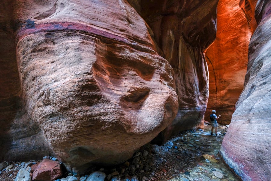
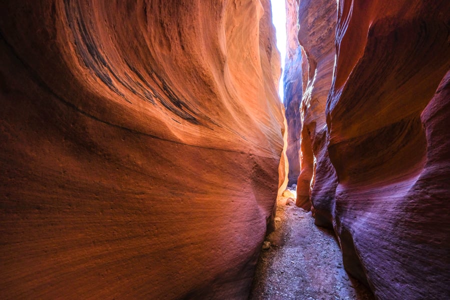
13. Peekaboo Canyon / Spooky Gulch (Escalante)
This is an amazing hike in Escalante with a total of three slot canyons, ranging from easy to moderate difficulty.
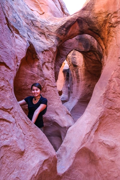
The Peekaboo Slot Canyon is like an adult playground, with lots of fun obstacles to cross and wonderful red rock walls to admire. It’s one of the most gorgeous slot canyons in Utah, featuring a heart shaped passage and arch ceilings.
Peekaboo is also moderately difficult and I wouldn’t describe it as an entry level slot, although beginners can still do it. The slippery ledge at the start of the slot is the main challenge, and it could be dangerous if you fall.
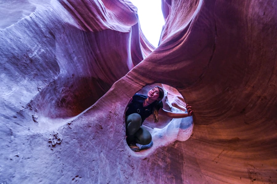
Peekaboo Canyon may be our favorite slot canyon Utah has to offer.
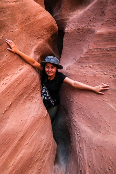
The other slot on this hike, called Spooky Gulch, is notable for being extremely tight. There are parts where you have to shuffle sideways just to fit your body through the slot, and backpacks have to be carried awkwardly overhead.
You don’t need any special gear or technical skills to do either of these slots, but you do need to be in good shape and not at all claustrophobic. In spite of the difficulty and awkwardness, we still had tremendous fun doing this trek, and it’s undoubtedly one of the best hikes in Utah!
If you want something easier, there’s even a third slot canyon here called the Dry Fork Narrows. It’s wider and tamer than the slot canyons at Spooky and Peekaboo, so you can just relax and enjoy the scenery as you walk through.
The trailhead for this hike is located in the Escalante area of southern Utah, about 1 hour from Bryce Canyon National Park. Escalante is also roughly halfway between Moab and Zion, so it’s a great place to add to your Utah road trip itinerary!
Distance: 3.5 miles (4 km) roundtrip
Elevation Gain: 300 feet (150 m)
Difficulty: Moderate
Read More: Peekaboo And Spooky Slot Canyons
14. Coyote Gulch Trail (Escalante)
Coyote Gulch is a photogenic canyon far off the beaten path in the Escalante area of southern Utah.
Go prepared. It’s a long hike and many people do it as an overnighter with camping permits, which are free and can be picked up at the trailhead. This is hiking in Utah at its best!
It’s also possible to do Coyote Gulch in one day if you have a good pace and know what you’re doing. Either way, you’ll want to bring lots of water, as well as a water filter to use in the streams.
This hike has four different trailheads to choose from, so you’ll need to research your route before you go. It’s well worth the effort, though, because you get to see multiple arches and waterfalls, including the massive Jacob Hamblin Arch!
Distance: 11 miles (18 km) roundtrip
Elevation Gain: 1,525 feet (465 m)
Difficulty: Moderate / Hard
15. Lower Calf Creek Falls (Escalante)
This is a unique-looking waterfall in the desert near Escalante. The colors are very unusual and nice.
The Lower Calf Creek Falls are 130 feet tall and there’s a cold pool below the waterfall for swimming.
The hike to the falls is easy and family friendly, and even the drive to the trailhead is scenic. Parking is limited though, and the hike is very popular, so you’ll want to start early and go on a weekday if possible!
Distance: 6.7 miles (10.8 km) roundtrip
Elevation Gain: 750 feet (225 m)
Difficulty: Easy
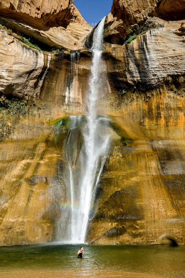
Lower Calf Creek Falls — one of the best waterfall hikes in Utah!
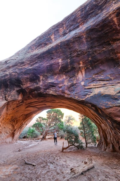
This beautiful loop hike is the perfect tour of Bryce Canyon National Park, with stunning orange and red rock walls and hoodoos surrounding you on all sides.
The Navajo Loop / Queens Garden trail is 3 miles roundtrip, and takes about 2 hours or less depending on your pace. It’s not a very hard hike overall, but there is a fair amount of elevation gain at the end.
Most people agree that the best way to do this trail is to start from Sunset Point and hike counterclockwise to Sunrise Point. Mornings are ideal to avoid some of the crowds and heat, although afternoon colors can be great.
This is the most popular hike in Bryce Canyon, and for good reason!
Distance: 3 miles (5 km) roundtrip
Elevation Gain: 650 feet (200 m)
Difficulty: Easy / Moderate
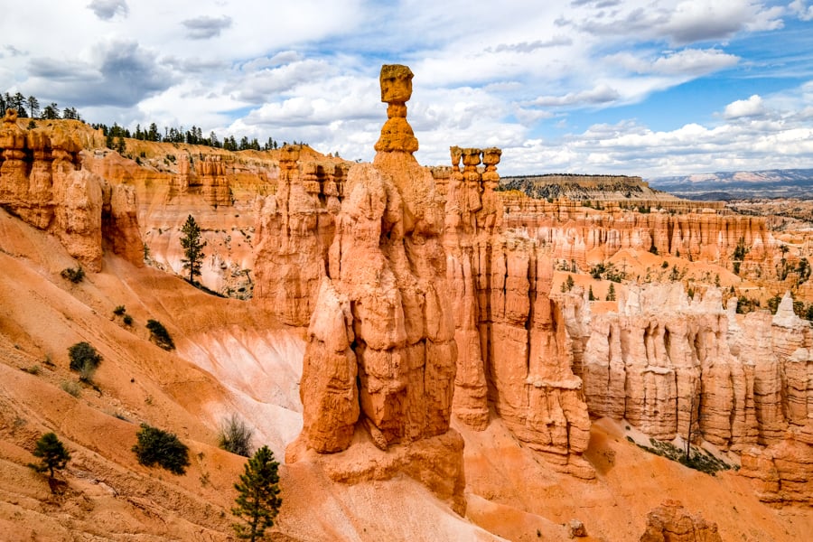
Great views of Bryce Canyon National Park
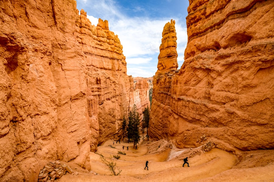
Navajo Loop Trail is one of our favorite hikes in Bryce Canyon
17. Stewart Falls (Provo)
The state of Utah may not be known for giant waterfalls, rainbows, and alpine scenery, but it has some of that too!
Stewart Falls is a 200-foot waterfall near Provo city. It’s an easy and family friendly hike to the falls, although if you take the final path to go down to the base of the falls it may be a bit steep and tricky for kids.
This is a great summer hike and nothing beats standing by a misty waterfall on a hot day! Dogs are allowed on this trail too.
Distance: 3.5 miles (5.5 km) roundtrip
Elevation Gain: 650 feet (200 m)
Difficulty: Easy
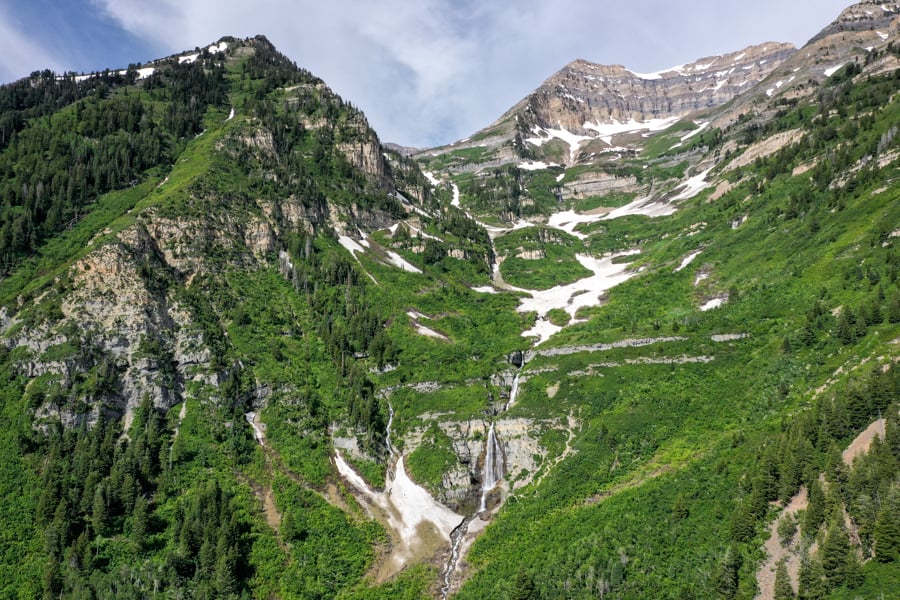
Drone pic of Stewart Falls and the Timpanogos mountains
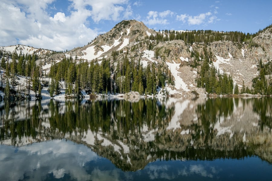
18. Lake Blanche (Salt Lake City)
Lake Blanche is a beautiful alpine lake trail near Salt Lake City and Provo, Utah. During the autumn, you can see amazing tree colors here.
The hike is never technical or dangerous, but it has a hefty 2,800 feet of elevation gain, so it’s strenuous. Bring plenty of water and count on hiking about 4 hours roundtrip.
At the lake you get nice close up views of Sundial Peak, and sometimes there might even be a moose bathing in the lake!
Distance: 6.8 miles (11 km) roundtrip
Elevation Gain: 2,800 feet (850 m)
Difficulty: Moderate / Hard
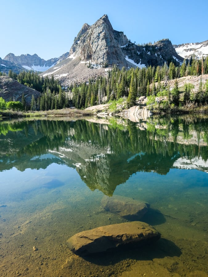
Lake Blanche — a reflection so perfect, it looks like the mountain is floating in the sky!
19. Toadstool Hoodoos (Kanab)
This is a short, easy hike in southern Utah that leads to some mushroom-shaped hoodoos and other rock formations that would make a perfect movie set for a desert planet in the Star Wars movies!
There are several groups of these toadstool hoodoos that can all be seen within a short walk of each other, and all of them are very photogenic and interesting. Dogs are welcome, but must be kept on a leash.
The trail has plenty of sun exposure, but there’s almost no elevation gain and it’s less than a mile to reach the hoodoo rocks, so just about anyone can do it. The most enjoyable time to come here is in the morning or evening, when it’s less hot.
Overall, this is the perfect hike for families and young kids!
Distance: 1.8 miles (3 km) roundtrip
Elevation Gain: 150 feet (45 m)
Difficulty: Easy
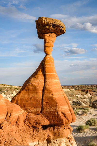
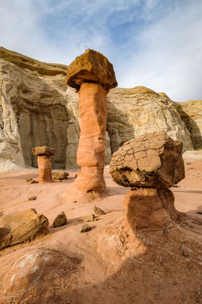
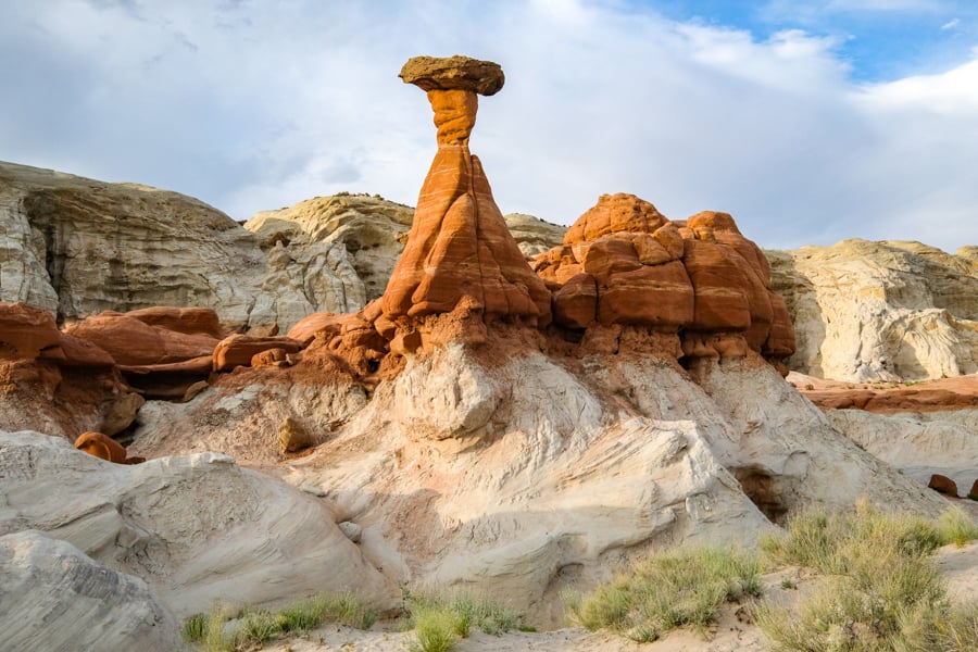
The wild and wonderful Toadstool Hoodoos — a perfect family hike in southern Utah!
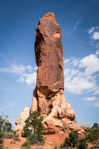
20. Wahweap Hoodoos (Kanab)
If you want to see alien landscapes, the Wahweap Hoodoos are one of the best hikes in Utah! I struggled with whether or not to include this hike on the list, because it’s such a long slog and most of the trail is uneventful.
However, this hike ends with one of the most bizarre and unique landscapes in Utah, where you can see dozens of white hoodoos capped by giant sandstone rocks. It’s like you’re in a different world.
Keep in mind, to get here you’ll be walking through an unmarked dry wash for over 10 miles roundtrip, with plenty of sand and even mud to slow you down. The entire hike is exposed, so bring sun protection and lots of water.
Spring and fall are the ideal times to do this hike. I don’t know if I’d recommend doing it in the summer at all, unless you start early in the morning and do your sightseeing before it gets too hot. This one’s a burner!
On the plus side, it’s a very quiet and secluded hike where you won’t ever have to worry about crowds. Watch out for Martians though.
Distance: 10.6 miles (17 km) roundtrip
Elevation Gain: 450 feet (140 m)
Difficulty: Easy / Moderate
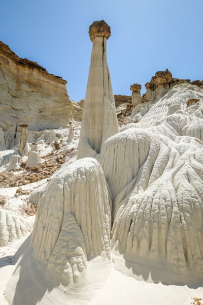
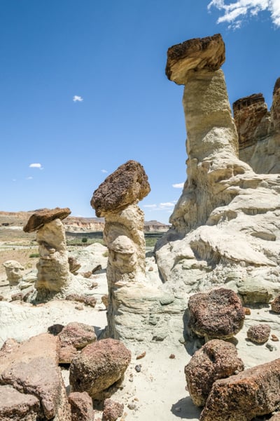
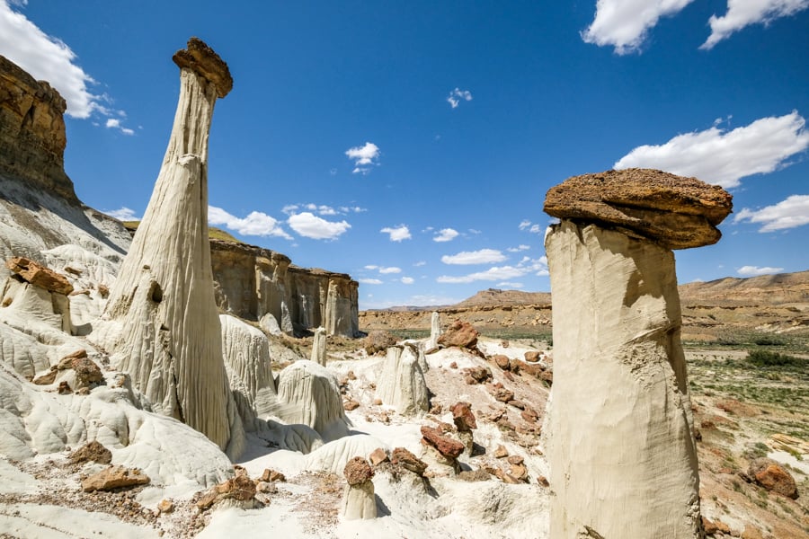
The Wahweap Hoodoos — one of the most unique places in Utah
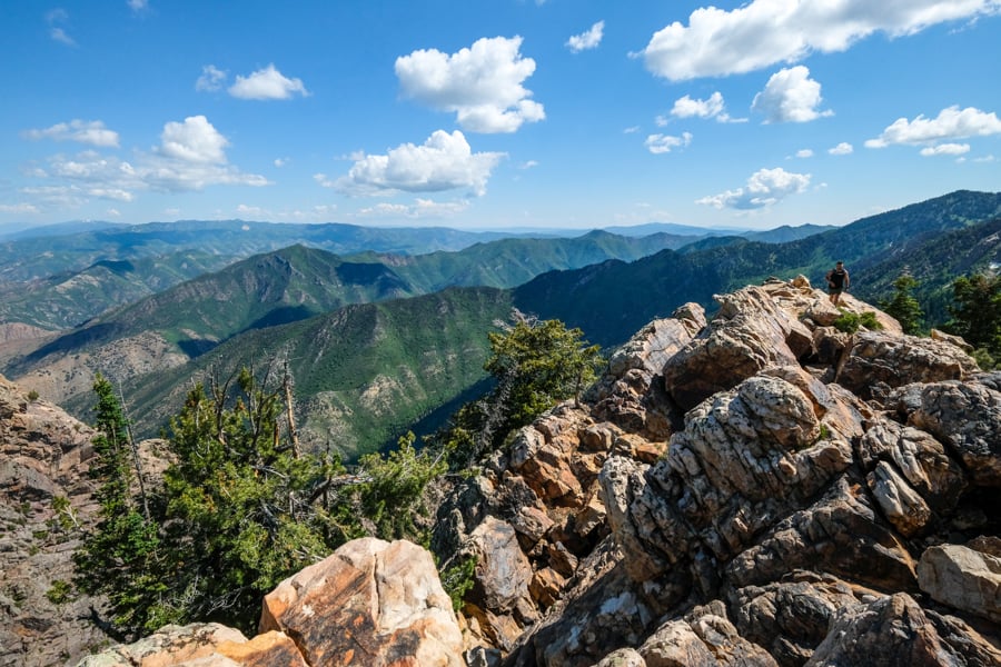
21. Mount Olympus (Salt Lake City)
Mount Olympus is a killer workout near Salt Lake City with wonderful panoramic views.
If you start in the morning, you can spend most of the time hiking in the shade, which makes it a lot easier and more enjoyable. Bring lots of water either way.
The last half mile of this hike involves steep rock scrambling and occasional rattlesnake sightings. It’s intense! I wouldn’t recommend going all the way to the summit unless you have scrambling experience, because a fall could be bad.
The peak of Mount Olympus has amazing views of Salt Lake City and the Wasatch mountains, and because of the difficulty, it’s usually not too crowded up there either!
Distance: 7.8 miles (12 km) roundtrip
Elevation Gain: 4,150 feet (1,265 m)
Difficulty: Hard
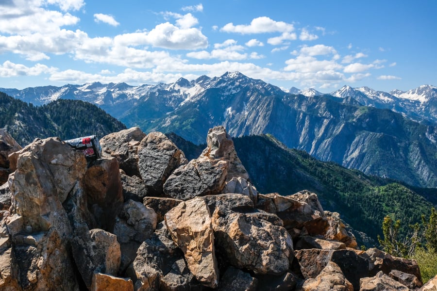
The summit view on Mount Olympus — one of best Utah hikes!
Views for miles
22. Bell Canyon Trail & Falls (Salt Lake City)
The Bell Canyon trail is an easy and family friendly hike near Salt Lake City where you can see a nice reservoir with ducks and geese, plus a 40-foot waterfall at the end of the trail.
Getting to the lower reservoir will be super easy for anyone, and it’s worth the hike in itself. You can reach it in just 15 minutes of hiking. Morning reflections on the water are superb.
If you decide to keep going to the Bell Canyon falls, the trail does get steeper and harder, but it’s still very manageable for most people. The stats below are for the full hike to the waterfall.
Distance: 4.8 miles (7.7 km) roundtrip
Elevation Gain: 1,500 feet (460 m)
Difficulty: Easy / Moderate
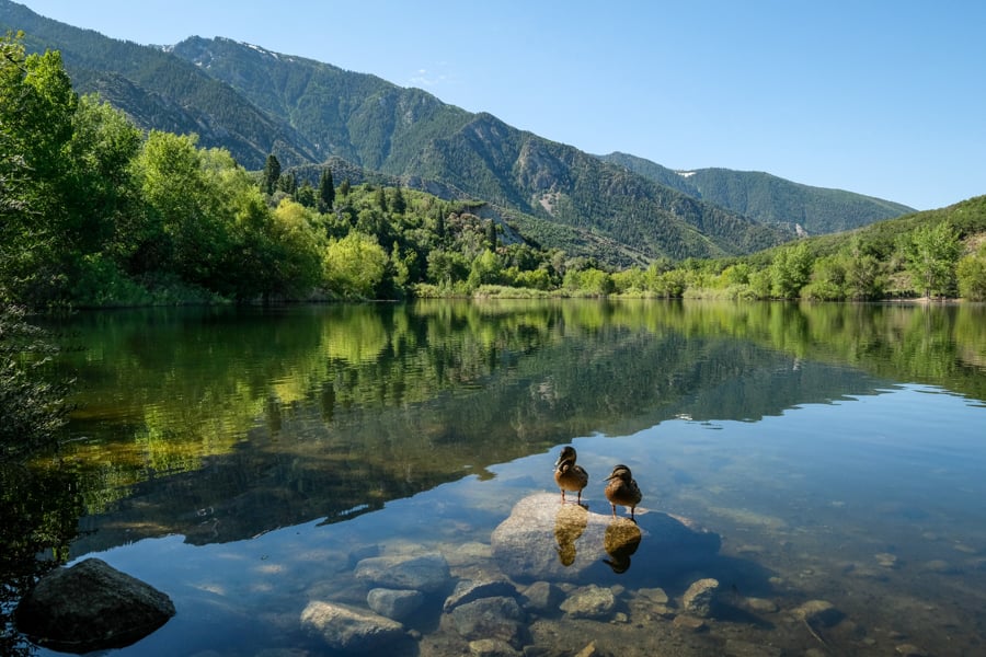
Lower Bell Canyon Reservoir is very easy to reach and has great views
23. Lake Mary Trail (Park City)
The Lake Mary trail is a nice hike in the mountains near Park City and Salt Lake City where you can see a total of three alpine lakes: Mary, Martha, and Catherine. Each of these lakes are outstanding!
This is another relatively easy hike, especially if you stop at the first lake. The stats below are for the first lake. Even if you choose to go to the third lake, it’s really not bad at all — in that case, you’d be looking at 4.5 miles roundtrip and a total of 1,250 feet of elevation gain.
All in all, it’s a great hike if you’re wanting to see mountains, alpine lakes, and wildflowers without too much effort. You also have a decent chance to see a moose!
Distance: 2.5 miles (4 km) roundtrip
Elevation Gain: 850 feet (260 m)
Difficulty: Easy
Lake Mary reflection
Map Of The Best Utah Hikes
Here’s a map of Utah hikes you can use to plan your own road trip. You can click the icons to get more info on each point of interest, but keep in mind some of the locations on this map may be approximate.
For more detailed information on how to find the exact trailheads for these Utah hiking trails, you can check out my individual travel guides for each hike.
As always, please remember to keep the trail clean, be considerate of other hikers, and leave no trace. Thanks and happy travels!
Best Waterfall Hikes In Utah
If you’re mainly wanting to see waterfalls, then here are some recommendations for the best waterfall hikes in Utah:
- Bells Canyon Falls (near Salt Lake City)
- Bridal Veil Falls (near Provo)
- Stewart Falls (near Provo)
- Kanarra Creek Falls (near Zion National Park)
- Faux Falls (near Moab)
- Lower Calf Creek Falls (near Escalante)
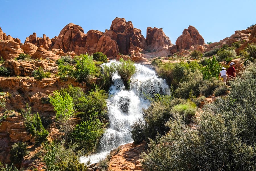
Faux Falls is a fun, family friendly waterfall hike near Moab
Best Slot Canyon Hikes In Utah
If you’re mainly wanting to do slot canyon hikes in Utah, then there are a lot of good ones to choose from! Here are some of our favorites:
- Little Wild Horse Canyon (near Moab)
- The Narrows (in Zion National Park)
- Red Canyon Kanab (near Zion)
- Kanarra Creek & Falls (near Zion)
- Buckskin Gulch & Wire Pass (near Zion)
- Peekaboo & Spooky Slot Canyons (in Escalante)
This is just a small selection of some of the most beautiful and enjoyable slots in Utah, and there are many more waiting to be explored.
Read More: Best Slot Canyons In Utah
More Utah Hiking Guides
Thanks for looking! I hope you enjoyed this list of some of the best hikes in Utah.
Don’t forget to check out my other Utah hiking guides for your road trip!
Best Utah Tours
Slot Canyon Safety Tips
Flash Floods. Always be aware of the weather forecast. Do not enter any slot canyon if rain is in the forecast, even if it's outside of your immediate area. Flash flooding can be very dangerous in a slot canyon.
Sunscreen. Even on a slot canyon hike, there are still plenty of parts on the trail where you'll be exposed to direct sun, so you might want sunscreen. A hat helps too.
Water. Try to pack at least 3-4 liters per person. In Utah, you should always bring more water than you think you need.
Map. It's a good idea to download an offline map of your hiking area on an app like Google Maps, that way you can keep using it to navigate or find your position even when you're out of reception. Getting lost in the desert can be dangerous.
See Also
- Slot Canyon Guide – Best Slot Canyons In Utah
- Zion Hikes Guide – Best Hikes In Zion National Park
- Angels Landing Zion Hiking Guide
- Antelope Canyon Arizona Tours: Which Is Best? (Upper, Lower, X)
1 comment
Thank you for sharing such a beautiful article about your travel experience !