The Corona Arch Trail is a nice, short hike near Moab, Utah with a total of three different natural sandstone arches.
It’s a fairly easy hike for all ages, and you get to see the Pinto Arch (optional), Bowtie Arch, and then finally the impressive 140 foot wide Corona Arch, which you can walk through.
This guide will explain how to do the Corona Arch hike, where to find the trailhead by Moab, and everything else you need to know before you go!
Quick Facts
- Distance: 2.5 miles (4 km) round trip
- Elevation Gain: 500 feet (150 m)
- Duration: 1 – 3 hours round trip
- Difficulty: Easy / Moderate
*These stats are only for the hike to Corona Arch (not including Pinto Arch and Bowtie Arch)
Corona Arch Trail: What To Expect
The Corona Arch hike is a canyon trail that takes you to two different nice arches (Corona and Bowtie), plus a third optional arch (Pinto) if you have time.
It’s all a pretty easy hike for the most part, and the only thing that might make it moderate is the mid-day heat and a short section where you have to climb a small ladder and stairway (but it isn’t dangerous).
Being so close to the town of Moab has made Corona Arch a very popular trail, so weekdays and mornings are best if you want to avoid the crowds.

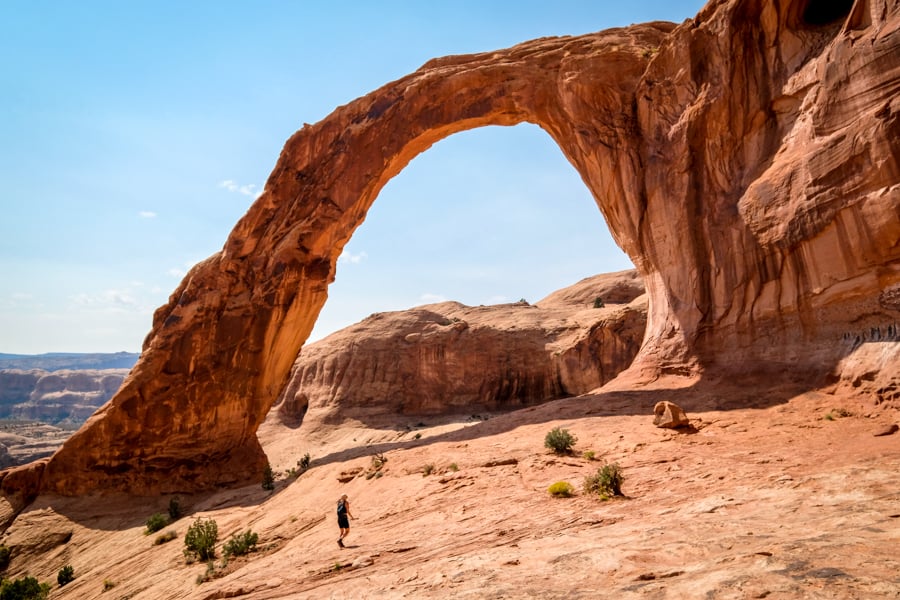
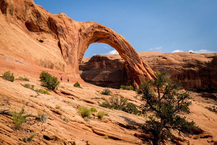
Corona Arch from the front. See the tiny person in the middle?
• Trail Beginning
The Corona Arch trail begins with a steep (but brief) trudge up a hillside, after which you cross some old Potash Railroad tracks that are apparently still in operation.
The trail is a bit primitive after this point, but there are always rock cairns and little green paint marks on the slickrock to show you which way to go.
Thanks to the green paint marks, which are a recent addition, it’s very hard for anyone to get lost on this hike nowadays.

Colorado River views near the start of the trail

Potash Railroad tracks
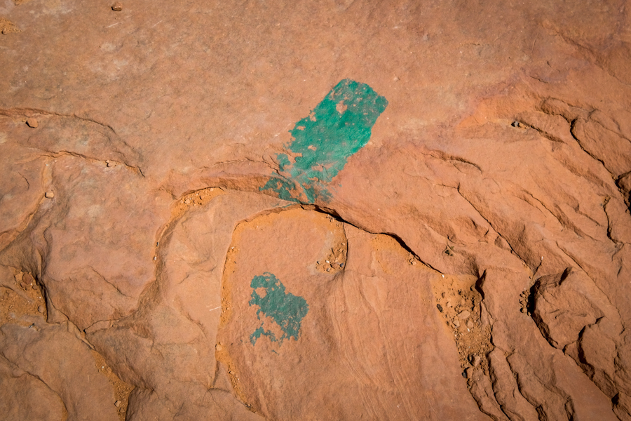
If you get lost, you can follow these green paint marks for pretty much the entire trail.
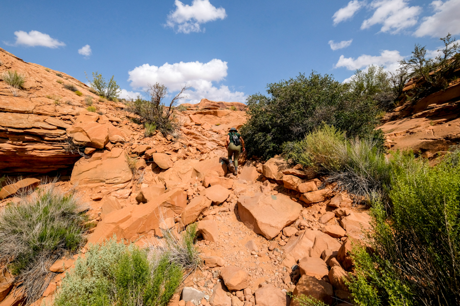
Primitive trail
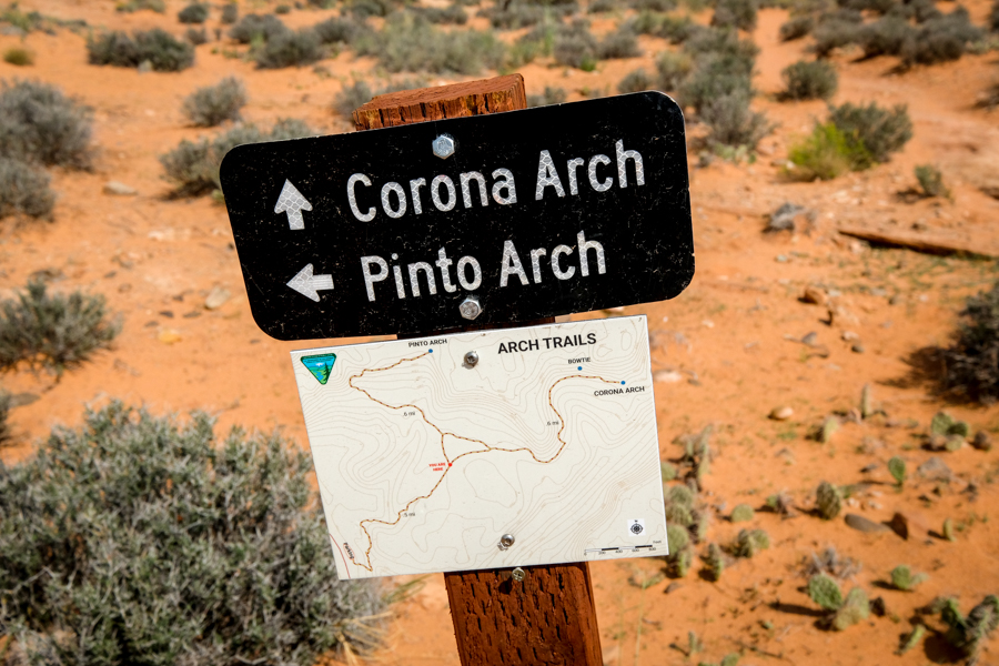
• Pinto Arch
Near the halfway point of the trail (about 1/2 mile in), there’s an optional out-and-back detour to go see Pinto Arch, a pothole arch at the top of the canyon.
You don’t have to feel obligated to do Pinto Arch, because it’s a steady uphill climb and the arch is honestly almost identical to Bowtie Arch, which you’ll pass anyway on your way to Corona Arch.
The main cool thing about Pinto Arch is that you can stand right under it, and see it from up close. That’s a bit harder to do at Bowtie Arch because of the step.
If you decide to visit Pinto Arch, just turn at the sign and follow the little green paint marks on the slickrock for an extra 0.6 miles (one way) and about 340 feet of elevation gain.
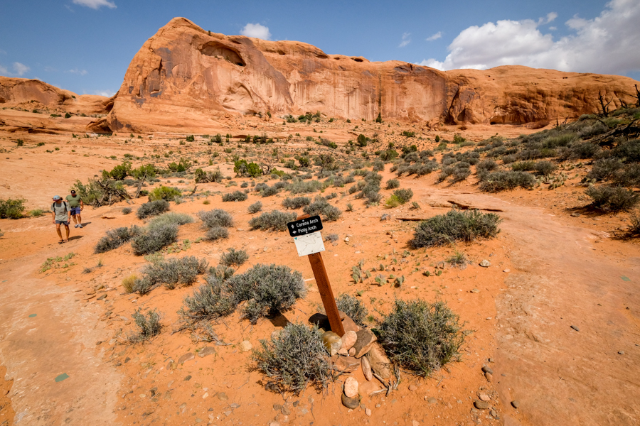
Junction for Pinto Arch
Pinto Arch sign and map
Pinto Arch
Pinto Arch
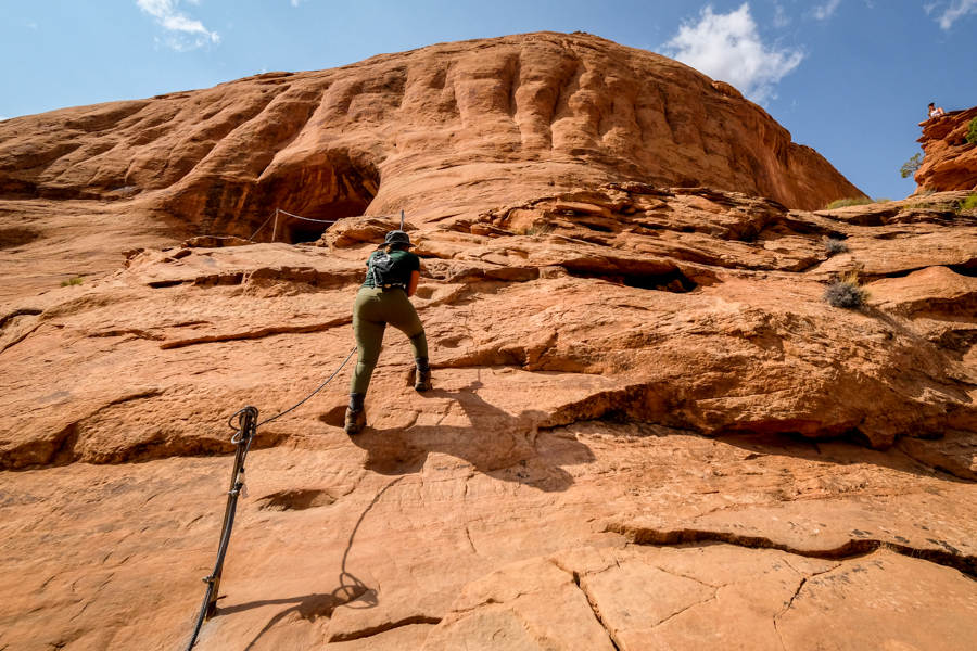
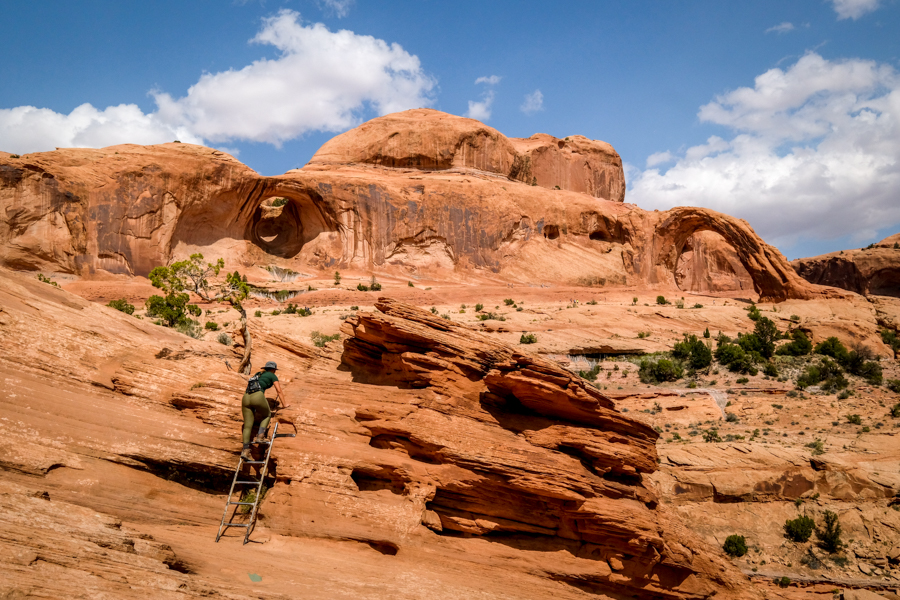
• Stairway / Ladder Section
The final hurdle of the Corona Arch hike is a steep slickrock stairway and cable, then a ladder you have to climb.
Dogs and kids can cross this section, but they’ll need a hand. The primitive stairway is pretty easy but you’ll have to grab the cable for support.
The ladder is about 6 feet tall, and a bit more intimidating. The last step is a big one, so it can be awkward going up or down, but it’s not as hard as it looks.
At this point, you can already see Bowtie Arch and Corona Arch in the distance. After you climb the ladder, just walk along the slickrock shelf the rest of the way to the arches.
Slickrock stairway and cable
First views of the arches
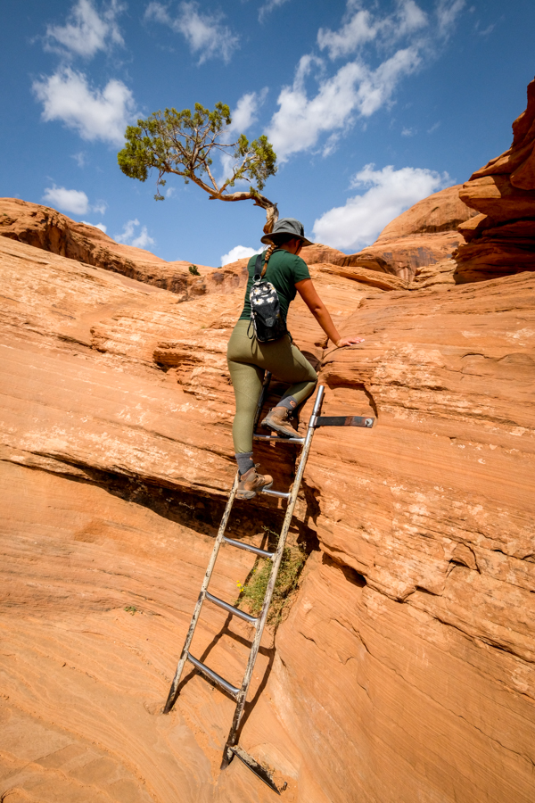
Ladder climb
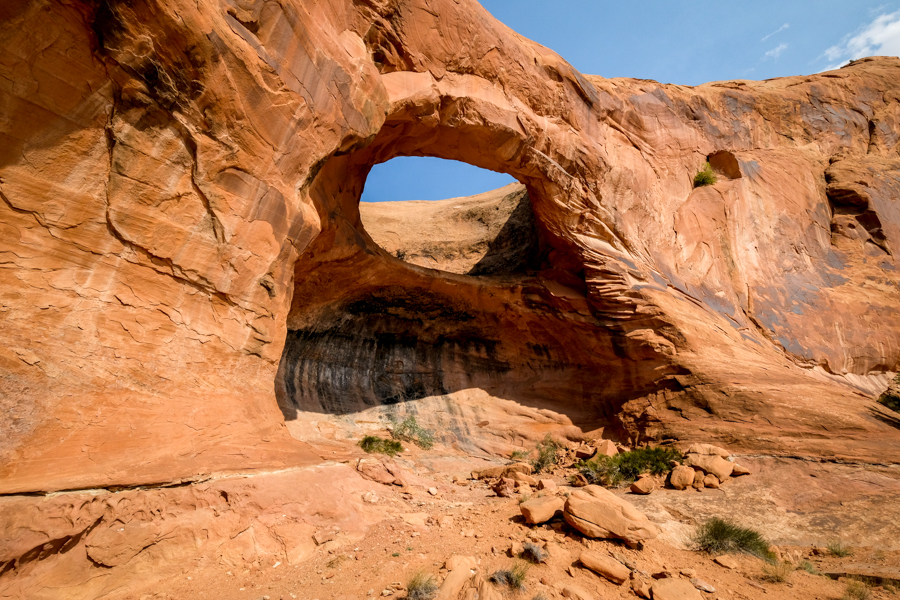
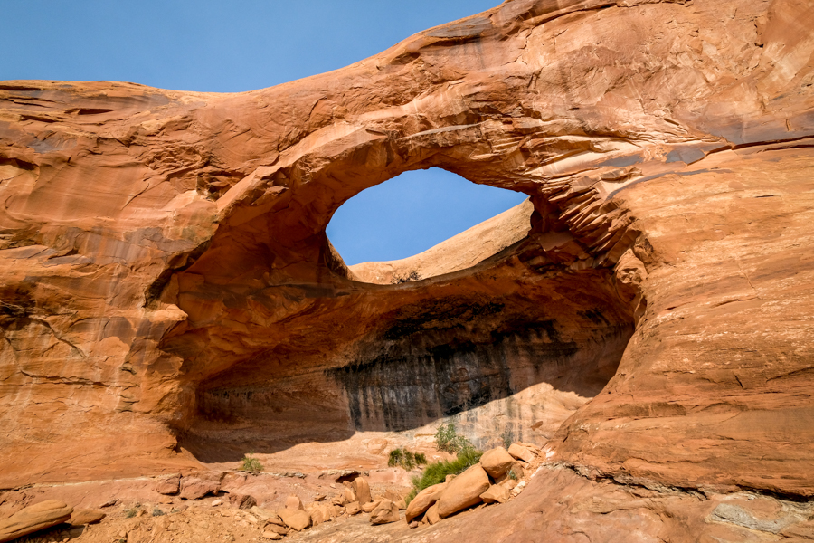
• Bowtie Arch
As you approach Corona Arch, you’ll first pass the Bowtie Arch on your left.
You don’t have to do any extra hiking to see Bowtie, and these two arches are just 150 yards apart, so you basically get two arches for the price of one.
The colors and texture of Bowtie are nice. It’s a pothole arch that formed when a pothole above the canyon filled with water and eroded down into a cave below.
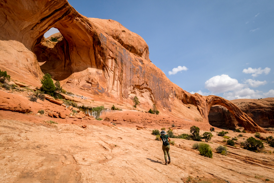
Passing Bowtie Arch on the left
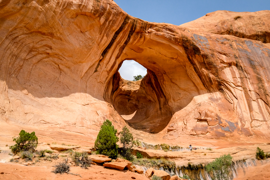
Bowtie Arch
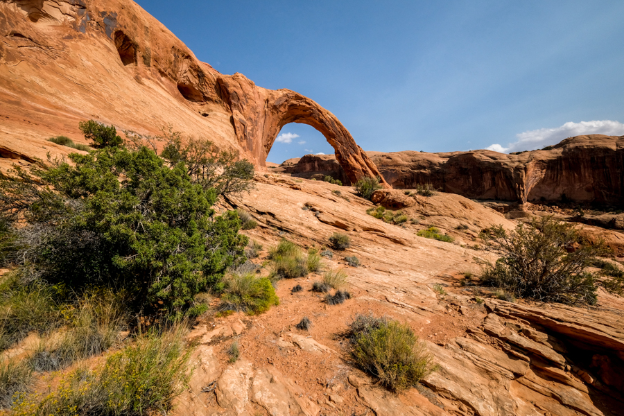
• Corona Arch
At last, you’ll reach your final destination — the impressive Corona Arch!
This is a natural sandstone arch that is 140 feet wide and 105 feet tall. You can walk through the arch to the other side, where there’s a giant stone face in the canyon wall (picture below).
Corona Arch may not be part of the Arches National Park, but it’s definitely one of the best arches in the Moab area!
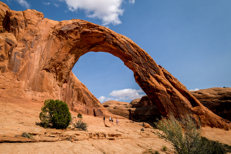
Corona Arch from the front
Back side of Corona Arch

The creepy looking stone face behind the arch
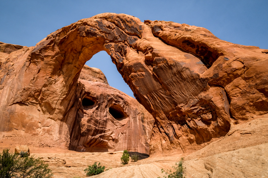
From this angle, it looks like a face with a gigantic arm or leg.
Corona Arch Trailhead: How To Get There
The Corona Arch trailhead is located right outside of Moab and the Arches National Park, in eastern Utah. It’s on Potash Road, which is home to some prehistoric dinosaur tracks and a bunch of other interesting sights.
Here are the GPS coordinates: 38.57806231735949, -109.63267036129403
You can also use the Google map below to navigate you directly to the parking area, which is a 20 minute drive from the town of Moab, Utah.
Trailhead Conditions
The road is paved all the way to the Corona Arch trailhead, so you don’t need high clearance or anything special to reach it.
When you arrive at the trailhead there’s a vault toilet, some information signs, and a trail map.
As always, please remember to keep the trail clean, be considerate of other hikers, and leave no trace. Thanks and happy travels!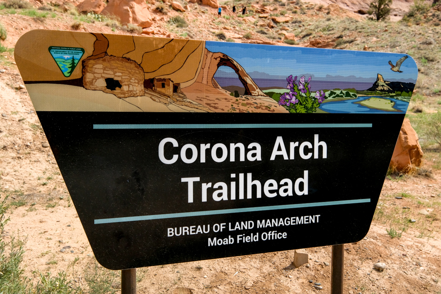
Corona Arch trailhead sign
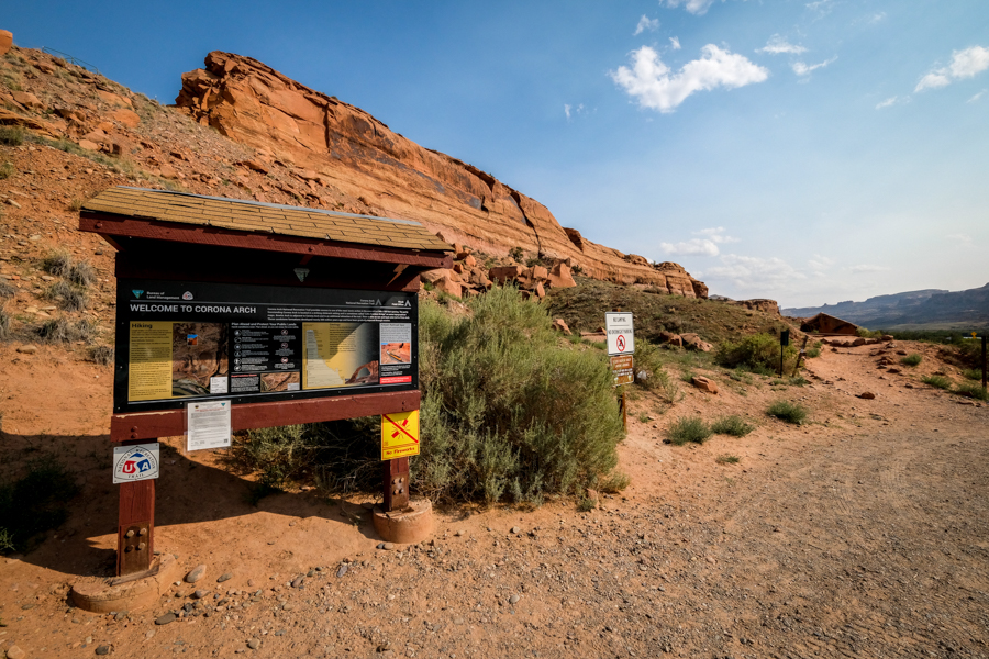
Information signs at the trailhead
Best Time To Visit
The Corona Arch hike is spectacular at any time of day, so it doesn’t really matter when you go, although the trail will be hotter and busier at mid-day.
Our photos on this page were taken in the early afternoon, specifically about 2 PM, and we were able to get photos of the arch from both sides without a bad glare from the sun.
This was in mid-September. In the early morning or late afternoon however, you might only be able to photograph the arch from one side because of sun glare.
If you go to Corona Arch at sunrise (or in the early to mid-morning hours), then your best bet is to walk through the arch and photograph it from the opposite side.
Otherwise, if you go to Corona Arch at sunset or in the late afternoon, it’s generally best to photograph the arch from the front.
One of the best arches in the Moab area!
Corona Arch Moab Utah
Corona Arch Swing
Back in 2011-2012, there were viral YouTube videos of people rope swinging off the top of Corona Arch, and it earned the nickname of ‘the world’s largest rope swing.’
Sadly, a Utah man accidentally jumped to his death from the Corona Arch swing in 2013 because his rope was too long.
The Bureau of Land Management banned the practice in 2015, so the Corona Arch swing is no more. The ban was supposedly temporary at the time, but they haven’t reevaluated it since then.
You can watch one of the old viral rope swing videos below. I have to admit it looked like a lot of fun.
Best Utah Tours
More Utah Travel Guides
Thanks for looking! I hope you enjoyed this guide for the Corona and Bowtie Arch trail near Moab, Utah.
Don’t forget to check out my other Utah hiking guides before you go!