The Blue Lakes Trail in Colorado is one of our all time favorite hikes, and the fantastic Lower Blue Lake might just be the nicest blue lake Colorado has to offer!
This is a moderate day hike that takes you on a scenic mountain path to an alpine lake with perfect turquoise water, and then a crystal clear middle lake and upper lake surrounded by impressive peaks.
You can do this hike on a day trip from Ridgway, Ouray, Telluride, or other popular areas in Colorado, and it doesn’t require too much driving from any of those areas.
This hiking guide will explain how to get to the Blue Lake trailhead in Ridgway, and everything else you need to know about the Blue Lake Trail before you go!

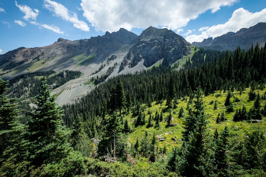
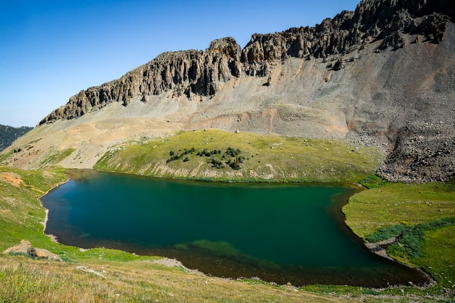
The Colorado blue lake from above.
Quick Facts
- Distance: 7 – 11 miles (10 – 18 km) round trip
- Elevation: 9,350 – 13,000 feet (2,850 – 3,950 m)
- Elevation Gain: 1,600 – 3,650 feet (500 – 1,100 m)
- Duration: 3 – 8 hours round trip
- Difficulty: Moderate / Hard

Views from the southwest side of Lower Blue Lake Colorado
Blue Lakes Trail: What To Expect
The Blue Lakes Trail in Colorado takes you to 3 different lakes and a scenic mountain pass. Most people only go to the Lower Blue Lake.
This is a very popular trail for day hikers and also backpackers, so weekdays are best if you want to avoid the crowds. Lots of people camp at the Lower Blue Lake on summer weekends.
The difficulty of the Blue Lake Trail depends on how far you go. I’d say it’s moderate to the first lake (and also dog friendly), but strenuous if you go to the second or third lake. Bring lots of water and snacks.
The sections below will explain each part of the Blue Lake Trail and what to expect. The entire hike is so worth it. These are some of the nicest blue lakes Colorado has to offer!

• Trailhead To Lower Blue Lake Colorado (Part 1 of 4)
Distance: 3.5 miles
Elevation Gain: 1,600 feet
Time: 1.5 – 2 hours
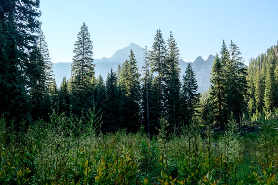
The Blue Lakes Trail starts out like most great Colorado hikes: a slow, steady climb through pine forests and meadows with the occasional distant mountain views.
Things start to open up after the first hour of hiking, and then when you’re almost to the first lake you’ll see a nice waterfall on your left.
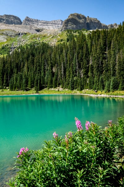
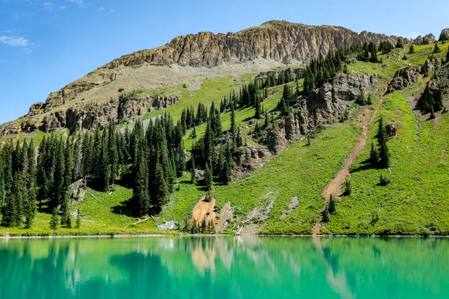
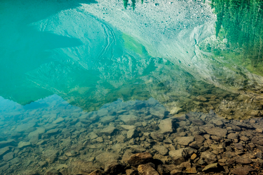
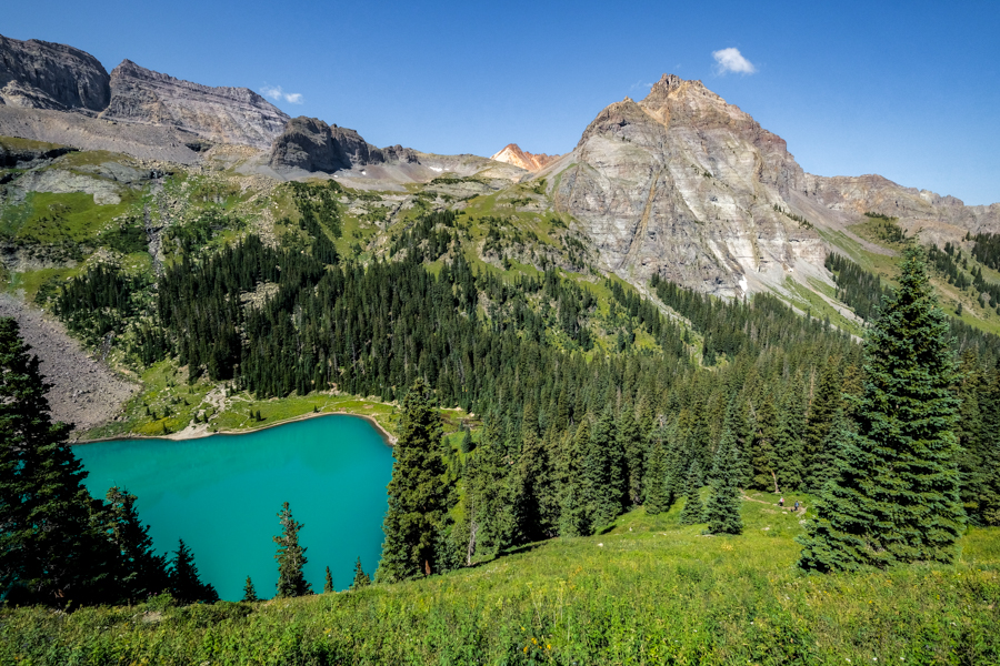
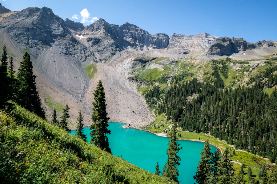
The first lake is called Lower Blue Lake and it is absolutely unreal, with perfect clear turquoise water surrounded by mountain peaks. It has to be the most perfect blue lake Colorado has to offer!
Take some time to walk around the lower lake and see it from all angles. We spent hours taking photos here after the sun came up, and I’m sure this part of the Blue Lake Trail is a wonderful place to camp too. You can also swim in the lake, although the water might be chilly!
The turquoise hues of the Colorado Blue Lake are just as impressive as what you see in pictures, although sunlight makes a big difference. On an overcast day, or early in the morning before the sun hits the lake, the colors aren’t as bright.
The photos you see on this page were taken on a mid-August morning and don’t have any photoshopping or saturation added!
Early mountain views
Getting closer
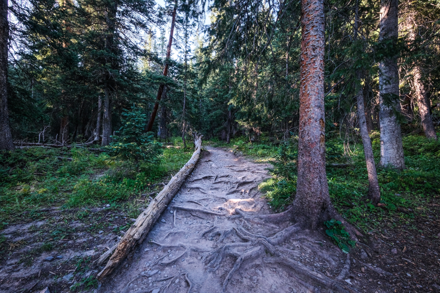
A quiet forest path
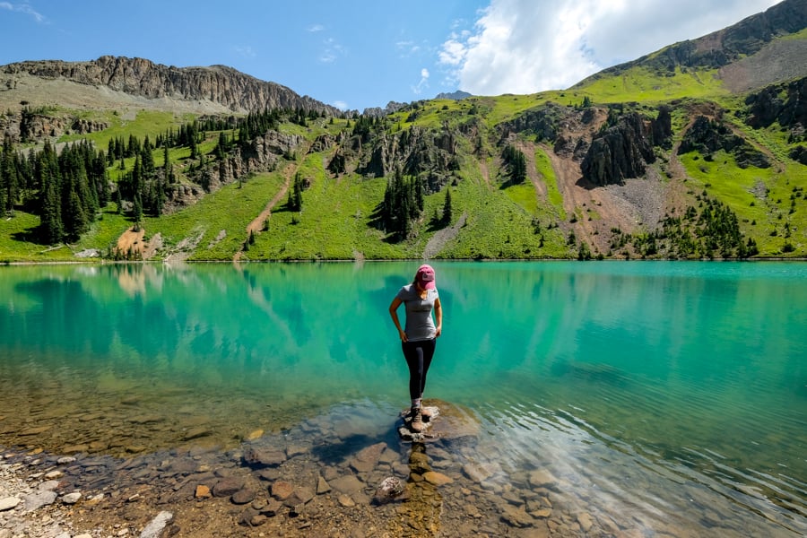
Surrounded by color at the Lower Blue Lake!
One of my favorite views on the Blue Lake Trail
The perfect teal hues of the Colorado Blue Lake
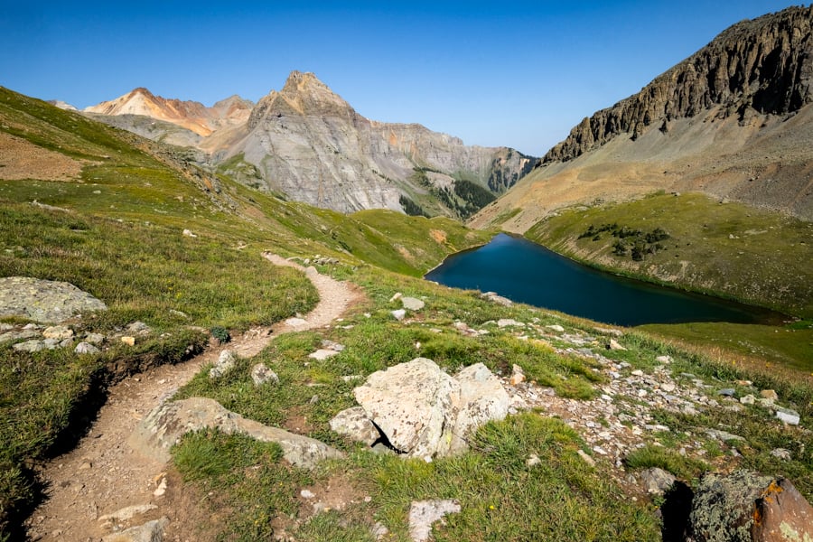
• Lower Blue Lake To Middle Blue Lake (Part 2 of 4)
Distance: 0.7 miles
Elevation Gain: 650 feet
Time: 30 – 45 minutes
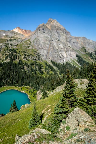
After you’ve admired the glassy shores of the Lower Blue Lake, you have to see how it looks from above! Plus, there are two more lakes waiting to be discovered on the Blue Lake Trail.
Go back to the wooden sign that marks the junction between lower and upper blue lakes, and turn left from where you first came in. There’s a small creek you’ll have to cross, but there are generally enough rocks and logs to do it without getting wet.
After crossing the creek, the path is unmarked and a little confusing. You need to head northeast up the slope of the rocky basin, and there are lots of paths that all converge in the same direction. Follow any of these and you should be okay.
The climb to the second (middle) lake is a steeper grade compared to the first part of the hike, but you get amazing views of the first lake from above, and lots of wildflowers along the way (in mid-July to mid-August).
The middle lake is the smallest of the three, and it doesn’t have the turquoise color of the lower lake, but instead seems to change from green to a dark blue color as you walk higher above the lake.
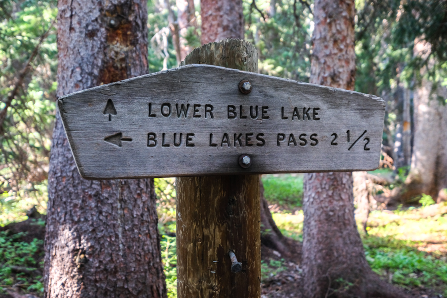
This sign marks the junction between lower and upper blue lakes. Turn left here to go to the upper lakes.
Views of the first lake on the way to the second one
Blue Lakes Basin. This might be one of the nicest blue lakes Colorado has to offer!
Middle blue lake
Looking back at the middle blue lake from above
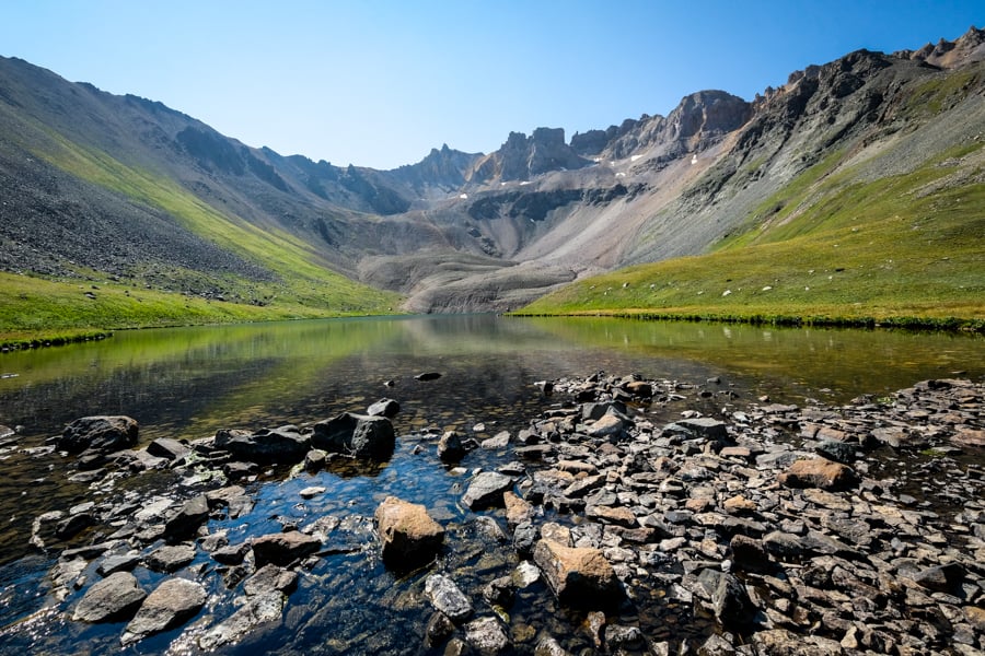
• Middle Blue Lake To Upper Blue Lake (Part 3 of 4)
Distance: 0.3 miles
Elevation Gain: 150 feet
Time: 15 minutes
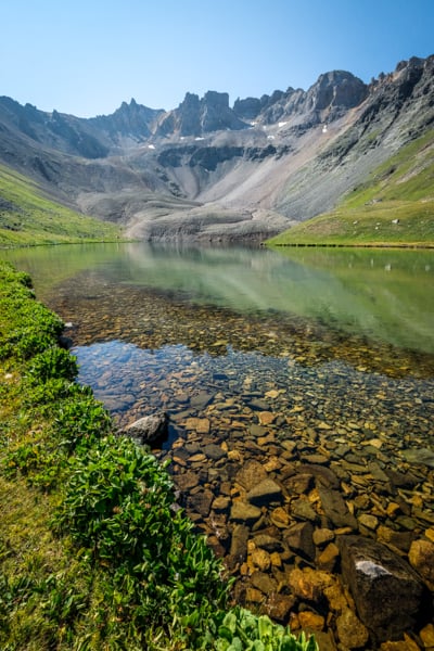
The path from the middle lake to the Upper Blue Lake is a straightforward walk that can be done in less than 15 minutes.
The upper lake doesn’t have quite the same blue colors as the other two lakes, but the water is incredibly clear, like glass! It also has way less people than the first lake.
First views of the upper blue lake
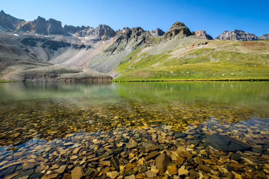
Glassy water at the upper blue lake
• Upper Blue Lake To Blue Lakes Pass (Part 4 of 4)
Distance: 1.5 miles
Elevation Gain: 1,250 feet
Time: 1 hour +
After you reach the upper lake, follow the path on the left (north) side of the lake to continue hiking up to Blue Lakes Pass.
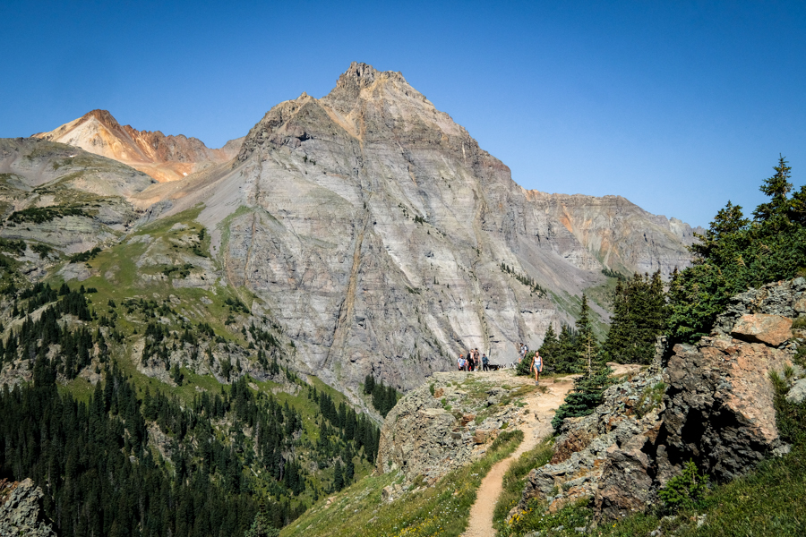
The final slog up to the pass is on steep, strenuous switchbacks. It’s a rocky path, but not too exposed or dangerous. This is the toughest part of the blue lakes hike, and most people turn around instead of going up to the pass.
The total one way distance from the blue lake trailhead to the top of Blue Lakes Pass is about 6 miles and 3,650 feet of vertical elevation gain. Quite a trek!
At the top of the pass, you’ll be rewarded with great views of the entire blue lake trail below you, and Yankee Boy Basin on the east side of the pass.
From here, you can retrace your steps to the blue lake trailhead, or make the difficult climb up Mount Sneffels (14,156 ft), but that’s a Class 3 route so it requires some research and experience before attempting.
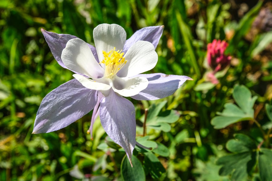
Columbine flower on the blue lakes trail
Mountain views on the way back down to the first lake
Blue Lake Trailhead Colorado: How To Get There
The main blue lake trailhead is located by Ridgway, Colorado. You can use the Google map below, or follow these GPS coordinates to get there:
- Main Blue Lake Trailhead: 38.02200152751049, -107.81835071502937
- Southern Blue Lake Trailhead: 37.99592041602135, -107.78459542282823
The best place to base yourself for this hike is either Ridgway, Ouray, or Telluride. The northern blue lake trailhead is about 45 minutes of driving from Ridgway, 1 hour from Ouray, or 1.5 hours from Telluride.
It’s also possible to do this hike in reverse, by starting from the southern trailhead in Yankee Boy Basin, but that route is probably not ideal for most hikers since it’s harder to visit the popular Lower Blue Lake.
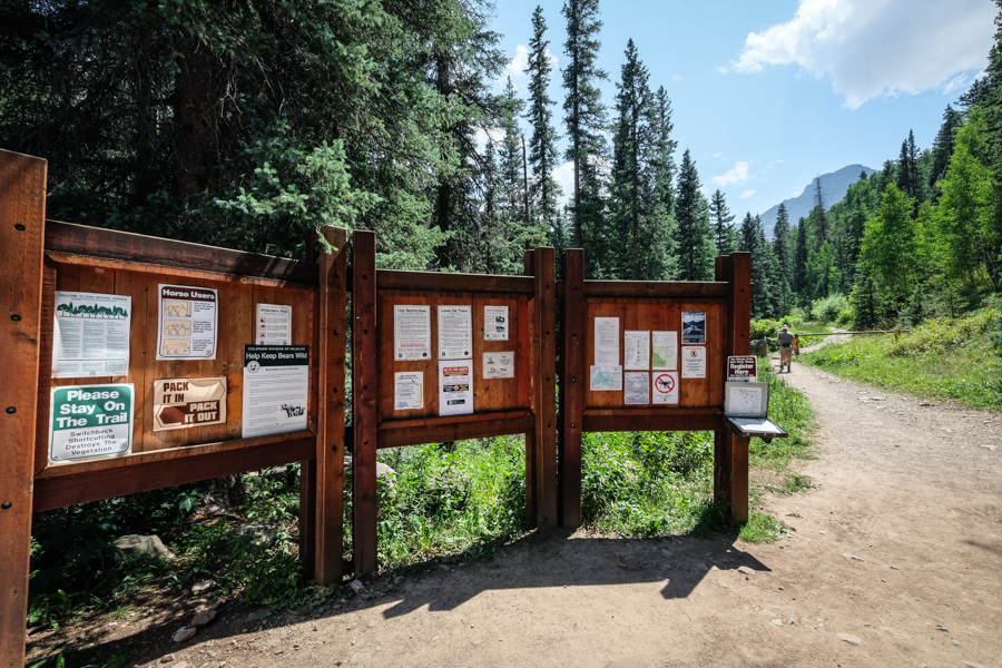
Information signs at the Blue Lake Trailhead by Ridgway, Colorado
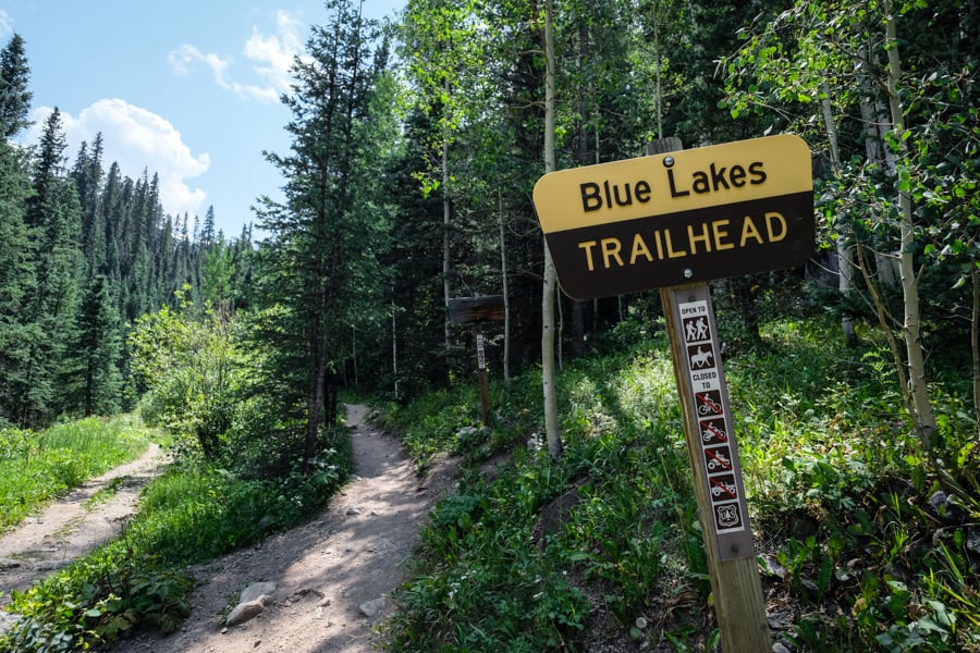
Start of the Colorado Blue Lakes Trail
Trailhead Conditions
Most of the road to the Blue Lake trailhead is in good condition and passable with any vehicle in the summer.
The last few miles do get increasingly rough, so it helps to have high clearance, otherwise you may have to dodge some potholes or park a bit back from the trailhead.
When you arrive at the trailhead there’s a vault toilet, some information signs, and a trail map.
As always, please remember to keep the trail clean, be considerate of other hikers, and leave no trace. Thanks and happy travels!
Where To Stay


Blue Lake Colorado Camping
Camping and fishing are possible on the Blue Lakes Trail in Colorado, and the Lower Blue Lake is supposed to be good for fishing cutthroat trout.
There are some great spots to camp at the lake, but it does get pretty crowded on weekends. Please remember to pack out anything you pack in, and leave the lake as clean as you found it. Enjoy!
More Colorado Hiking Guides
Thanks for looking! I hope you enjoyed this guide for the Blue Lake Trail near Ridgway, Colorado.
Don’t forget to check out my other Colorado hiking guides before you go!
13 comments
Thank you for this information! Beautiful pictures!
Sure, thanks!
This was so informational. Thank you so much
Welcome!
Thank you! I was skeptical of this hike. It makes sense now, after you broke it down. Thank you for the details!
Thanks. Enjoy!
Do you have to pay to camp there
No fee to camp there as far as I know, but the wilderness regs apply. You can read more here: https://www.fs.usda.gov/recarea/gmug/recarea/?recid=32558
Very good info
Hi there. My group of 7 women are backpacking the Sneffels Traverse and considering adding the Blue Lake hike to our already 30 mile trek from Telluride to Ouray. I’m not exactly sure which lake we would get to, but have been told that it would be an additional 8 miles and almost 2,000 vertical feet from the hut we will be staying. Everyone is interested in going as we’ve seen photos of the teal/turquoise water. Can you tell me if just the lower lake is this color? Can you see that lake from the upper lake? Thank you.
Hi Wendy. Sounds like a great trek! Only the lower lake has the bright teal water color. You can’t see it from the upper lake, but you can from the middle lake. There’s a viewpoint near the middle lake to look down on the lower lake, so you can enjoy seeing the color from above there. Hope this helps!
Amazing information and easy to understand. Thank you for your breakdown. Can you swim at Lower Blue Lake?
Thanks, yes you can swim there although the water might be chilly! Enjoy.