The Mount Agung hike takes you to the top of the biggest and baddest volcano peak on the island of Bali, Indonesia, and the sunrise views are out of this world.
This brutal trek takes you up the steep slopes of an active volcano until you’re staring into the massive crater itself. I did the Mount Agung hike recently, and it was one of the most difficult and thrilling things I’ve ever experienced.
Sunrise trekking at the Mount Agung volcano is especially popular because you can catch amazing views of the sunrise from the top of the mountain, usually in a sea of orange clouds.
This travel blog will explain how you can hike Mount Agung, with or without a tour guide, and everything else you need to know before you go!
Quick Facts
- Distance: 8 kilometers (4 mi) return
- Elevation Gain: 1,500 meters (~5,000 ft)
- Top Elevation: 3,142 meters (10,308 ft)
- Duration: 8 – 12 hours return
- Difficulty: Hard
Where Is Mount Agung?
The Mount Agung volcano is located in Karangasem regency, in the northeast corner of Bali island.
It’s about 2 hours’ drive from Kuta, Canggu, and Sanur, or about 1.5 hours’ drive from Ubud.

Mount Agung volcano as seen from Sidemen village
About The Mount Agung Volcano
Mount Agung (also known as Gunung Agung in Indonesian) is the highest point in Bali, and at 3,142 meters it’s one of the top 100 prominent peaks on Earth. My wife informs me that the name means ‘Great Mountain’.
Gunung Agung was long considered the ‘navel of the world’ by Balinese, and it’s still sacred in their beliefs. If you do this hike with a local guide, he’ll make a few stops along the way to burn Hindu incense and pray.
Balinese respect mountains as the dwelling place of the gods, and in old times you couldn’t climb Agung without a Hindu priest present.

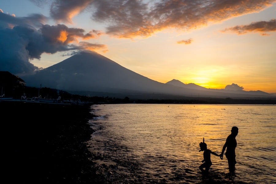
Mount Agung sunset as seen from Amed village
Mount Agung Eruption History
Mount Agung is an active volcano that’s had some major eruptions throughout history. In 1963, a catastrophic eruption wiped out the nearby villages and killed 2,000 people.
The last Mount Agung eruption was the one in 2017-2019, when it exploded with a giant 4 kilometer tall ash cloud that caused mayhem in Bali. More than 100,000 locals in Karangasem were evacuated, and hundreds of tourist flights were canceled or diverted.
Nowadays, any signs of impending volcanic activity at Agung are constantly monitored by the Indonesian government, and if there are tremors sometimes the mountain is closed to hikers.

Mount Agung eruption in 2017 (© Shutterstock)

Mount Agung eruption in 2017 (© Shutterstock)
Mount Agung Safety
Obviously there is no guarantee of safety if you climb Agung. This is an active volcano, so there will always be some measure of risk involved.
However, it seems the catastrophic eruptions are usually spaced apart by several decades (after a long buildup of pressure), and most years don’t see any significant volcanic activity at all.
Personally I found the risk level acceptable, and I would love to climb Agung again sometime. Know your limits, though! This is a serious hike and you need good mobility.
There have been at least half a dozen falling deaths on the Mount Agung hike over the years, including one as recently as 2022. However, these have generally been a result of unfit / older hikers, bad weather, or hiking without a guide.
Mount Agung: Current Alert Status
As of 2024, Mount Agung is currently at Level 1 alert status (‘normal’) according to the Indonesian government’s volcanological survey.
This is the lowest risk level, and it means the mountain is open for hiking once again! There are no legal barriers to climb the mountain now, but remember to double check on the alert status again before you go.

Looking into the crater of the Mount Agung volcano. What a hike.
Best Mount Agung Tour Package
Here is a Mount Agung trekking tour package that you can book online. They offer the sunrise trek starting from either Pasar Agung Temple or Besakih Temple, although it’s more cost effective if you go with a friend (they charge a 2 pax minimum).
We’ve used Klook for lots of tours and activities around the world, and they’re great. Highly recommended!
Book Now: Mount Agung Sunrise Trekking Tour
Mount Agung Hike: What To Expect
Sunrise Trekking
Most people do Mount Agung as an overnight hike, in order to arrive at the top for sunrise. One of the main benefits of this is that the early morning tends to be clear more often than not, whereas the volcano is usually totally covered with clouds in the daytime.
Mount Agung sunrise tours start with a very early pickup (maybe 11 PM-ish) so your guide can drive you to the trailhead for a hike to the top of the volcano in time for sunrise.
This means you’ll be operating on very light sleep (if any at all), compounding the difficulty of the whole trek. Ever tried staying up all night while hiking for 8 to 12 hours on an extremely steep, rocky volcano in the dark? Chances are, probably not.
The Mount Batur sunrise hike is a good warmup for this one because the mechanics and terrain are similar, although Batur is much shorter and easier than Agung.
The Mount Agung trek can be broken down into 3 phases:
- Part 1 — A dirt path winds through fern trees, pines, and vegetation. There are no real switchbacks, so the entire trail is uphill and strenuous, but this is the easiest phase of the hike.
- Part 2 — Exit the treeline and weave your way through boulders, scree, dirt, and dust as the trail gradually gets steeper. This is the longest leg of the trek. It feels like it lasts forever.
- Part 3 — Scrambling up the rest of the mountain on all fours. This is the hardest part of the Mount Agung hike, and some spots are steep enough to be dangerous if you’re not careful. A good headlight and guide are essential here.
My wife, bless her heart, gave up shortly after we exited the treeline. She was too exhausted to keep going, the path was getting more sketchy, and the wind that day (late August) was terrible. We agreed to keep the guide with her for safety, and I pressed on to the summit alone in the dark.
The fact that my headlight was weak and I was running late for sunrise added some more urgency. I’ll never forget that moment: I was clinging to the side of a steep volcano, half asleep and beat to pieces, when the sky turned orange and I realized I was high above the clouds.
It was a really special moment.

First peep of sunrise on the Mount Agung trek

High above the clouds. This was one of the less steep sections near the end.
Ahead, you have the huge smoking 900-meter-wide crater of Agung, and you get to look straight down into it from the crater rim. Watch your step, because there’s not much walking space at the top and people have fallen into the crater. You don’t want to be a sacrifice to the gods.
The views at the top are otherworldly. To the east and west, you can see the far off peaks of Mount Rinjani and Mount Abang, along with the giant Batur caldera in Kintamani. To the south, you can see all the way to Kuta.
The beauty of the Mount Agung hike is only outweighed by the difficulty and sense of achievement when you reach the summit.

On this day, the crater rim was packed with locals doing the Mount Agung trek.

Drone picture of the Agung crater.
How Hard Is It?
The Mount Agung hike is very, very hard. It’s brutal. Mount Batur is a joke by comparison. The Agung hike is several times harder than Batur.
You don’t have to be an expert mountaineer to do this hike, but just being fit is not enough. You also have to be determined. Depending on which trail you take (see below), the hike can take up to 12 hours roundtrip, and you’ll gain up to 2,150 meters (7,000 feet) of elevation. That’s insane.
The last part of the hike is very steep, and in some places you’ll be climbing almost vertical in the dark. There were times when I seriously considered turning back, which is an unusual feeling for me.
For reference, I’ve done the Mount Everest Base Camp trek, almost a dozen ’14ers’ in Colorado, Hawaii’s illegal Stairway To Heaven, the Kalalau Trail, Half Dome, and other famously difficult hikes, but Agung is still one of the hardest things I’ve ever done.
After the Mount Agung trek, we ate two meals each, collapsed at our hotel in Amed, and slept for 16 hours straight. We could barely walk for days.

The wind kicked up so much dust and smoke it almost looked like the volcano was erupting!

High above the clouds on Gunung Agung
Hiking Route – Besakih Temple vs. Pura Pasar Agung
There are two main routes for hiking Agung. One starts from the famous Besakih Temple, while the other starts from a smaller temple called Pura Pasar Agung:
- Besakih Route. This is the longest route. There’s an absolutely massive elevation gain of 2,150 meters (7,000 feet), and the hike takes 12 hours roundtrip. This route takes you to the true summit of Mount Agung at 3,142 meters (10,308 ft).
- Pasar Agung Route. This is the shortest and most common route. The elevation gain is 1,500 meters (5,000 feet) and the hike takes 8 hours roundtrip. This route doesn’t take you to the true summit, but instead takes you to a false summit on the south crater rim at 3,031 meters (9,944 ft).
Both routes are very difficult. The Pasar Agung route gives better views of the inside of the volcano crater, while the Besakih route ends on a tall ridge with great views of the whole landscape.
From the Pasar Agung trail it used to be possible to also reach the final summit using a side path that joins the Besakih trail partway up, but apparently this path was ruined in the 2017 eruption.

Pura Besakih temple pagodas

Pura Pasar Agung main temple gate
What To Bring
- Jacket: Bring two extra layers for the Mount Agung trek. You won’t need them for most of the trek, but at the top it can be very windy and cold before sunrise.
- Footwear: Sturdy hiking shoes with good grip are a must for the Mount Agung hike. You’ll be walking on slippery gravel and steep inclines or declines.
- Poncho: Weather can change on the mountain, so you might want to bring a rain jacket just in case.
- Water: Bring at least 2 liters per person. The elevation gain is massive, and near the summit you’ll also have a bit of mild altitude sickness making you dehydrate faster.
- Snacks: Energy bars for when you feel like you can’t take another step.
- Headlight: This is absolutely essential for finding your way up safely in the dark. Mount Agung trekking tours for sunrise will provide cheapo headlights, but a quality light of your own will be even better.
- Camera: Essential! Drone pictures here are amazing too, if you can bear the extra weight. You can see some of my Agung drone footage in this video.

The Mount Agung Bali crater. On the left, you can see the final summit.

Another drone picture from the Mount Agung Bali hike.
Best Time To Trek
You could theoretically do the Mount Agung hike any month of the year, but this is already an intense hike and with rain coming down it would be 100 percent nightmarish and unsafe.
The best trekking months are definitely April to October, when there’s less chance of rain and the mountain visibility is best.
In my opinion, the best time of day to hike Agung is at night, that way you can get the clearest visibility (and a great sunrise) in the morning when you reach the top. However, it’s also possible to hike the mountain in the daytime if you prefer.
Some people even do a 2-day trek for the Besakih route and spend one night camping on the mountain.

Mount Agung sunrise at the crater rim.

Inside the volcano crater you can see red lava imprints in the rock layers.

The crater rim elevation here is 3,031 meters, about 100m shy of the actual summit.
Mount Agung Tour Guide / Mafia Requirement
Just like at Mount Batur, there’s a local trekking group (mafia) that doesn’t let anyone climb the Agung volcano without paying for a local Balinese tour guide.
This time around, a guide definitely makes sense for both safety and navigation. There are several steep spots on the Mount Agung trek where you could be killed or seriously injured if you fall, especially in the dark. Having a guide to show you the easiest paths helps a lot.
I didn’t notice any ‘guards’ enforcing the guide rule when we went, but that was during the 2020 covid pandemic when all the tourists were gone from Bali and things were quieter, so your experience may vary.
It seems a lot of Russian hikers try to climb Mount Agung without a guide, and they routinely injure themselves, go missing, or worse. Hikers have fallen and died on this mountain as recently as 2022.
Using a local guide is just the smartest and safest thing to do in this situation.
Book Now: Mount Agung Sunrise Trekking Tour

Flowers near the start of the Mount Agung trek.

Foggy forests on the way back down from the Mount Agung trek.

One of the last pictures I took on the way back from the Mount Agung hike.
Mount Agung Without Guide – Directions
If you’re resolved to hike Mount Agung without a tour guide, the first hurdle is finding the trailhead at night. You’ll need to follow the directions below carefully.
Park your vehicle at Pura Pasar Agung and start walking up the concrete steps until you see the main gate of the temple. It’s the pointy Balinese gate shown earlier in this guide.
When you reach the gate don’t go inside, but instead turn left and walk around the outside of the temple. Go down a small flight of stairs, and then straight across the flat concrete foundation near the side of the temple.
At the edge of the trees, you’ll see a small path leading into the jungle. Follow this path and keep going up, up, up the slope until you emerge from the treeline hours later near the mountain top.
When you get above the treeline, the path becomes harder to follow. Some of the boulders are marked with white spray paint arrows and Indonesian words, but these are almost impossible to see in the dark.
The best advice I can give for the scrambling section is to take a right turn any time you encounter a fork in the path. To reach the crater rim, you’ll have to cross a trough by climbing up the rocks on the right side.
Again, I would strongly advise not to hike Mount Agung without a guide.


Where To Stay
There aren’t really any homestays near the Mount Agung trailhead, so you’ll have to base yourself elsewhere in Bali.
The closest place to base yourself is Sidemen, Candidasa, Amed, or Kintamani. Of course, you can also do this hike from the touristy areas like Ubud or Kuta, but there’s a bit longer drive in each direction.
Personally I’m a big fan of Amed, because it’s also a chill place to relax after the hike and you get awesome views of the Agung volcano from the beach.
Happy travels!
Mount Agung sunset at Amed Beach
More Bali Travel Tips
Thanks for looking! I hope you enjoyed this Mount Agung trekking guide.
Don’t forget to check out my Bali Travel Guide and my complete list of the best hikes in Indonesia!
Bali Private Driver & Motorbike Rental
If you want to explore Bali in the comfort and safety of a private car with an English speaking driver, my top recommendation would be GetYourGuide.
Their price is 650k Rupiah ($45 USD) for a full day of driving and sightseeing in Bali (up to 10 hours) for 1-5 passengers. That's the total price for the whole car + driver + petrol! It's a great deal. They also offer affordable hotel transfers from the airport.
If you'd rather travel by motorbike, they have that too. Their scooter rentals start at 140k Rupiah (~$9) and include a helmet, rain coat, and free delivery in the south Bali area.
We've used GetYourGuide for lots of tours and activities around the world, and they're great! Highly recommended.
Book Now: Bali Private Driver / Scooter Rental
Ubud Hotels


See Also
- Bali Beach Guide - The Best Beaches In Bali
- Bali Waterfalls Guide - The Best Waterfalls In Bali
- Bali Temple Guide - The Best Temples In Bali
- Bali Travel Guide - Info, Pictures, & Blog
- Nusa Penida Island Guide - How To Visit From Bali
- Most Beautiful Indonesian Islands - Best Places To Visit In Indonesia
- Best Hikes In Indonesia - Volcanoes, Jungles, & Waterfalls
4 comments
The photos are breath-taking.
Thank you!
very good write for traveler, i hope you can write about mount rinjani in lombok
Hopefully sometime!